File:(Chioggia) - Telamoni Corso del Popolo.jpg

Page contents not supported in other languages.
This is a file from the Wikimedia Commons
From Wikipedia, the free encyclopedia

Original file(6,112 × 9,184 pixels, file size: 25.32 MB, MIME type: image/jpeg)

Summary

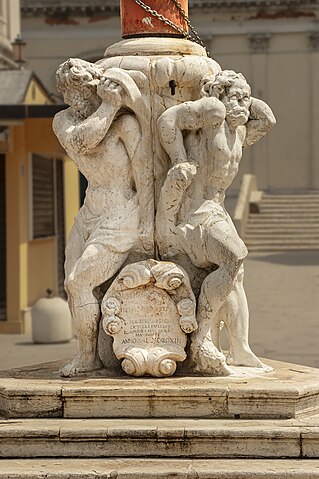
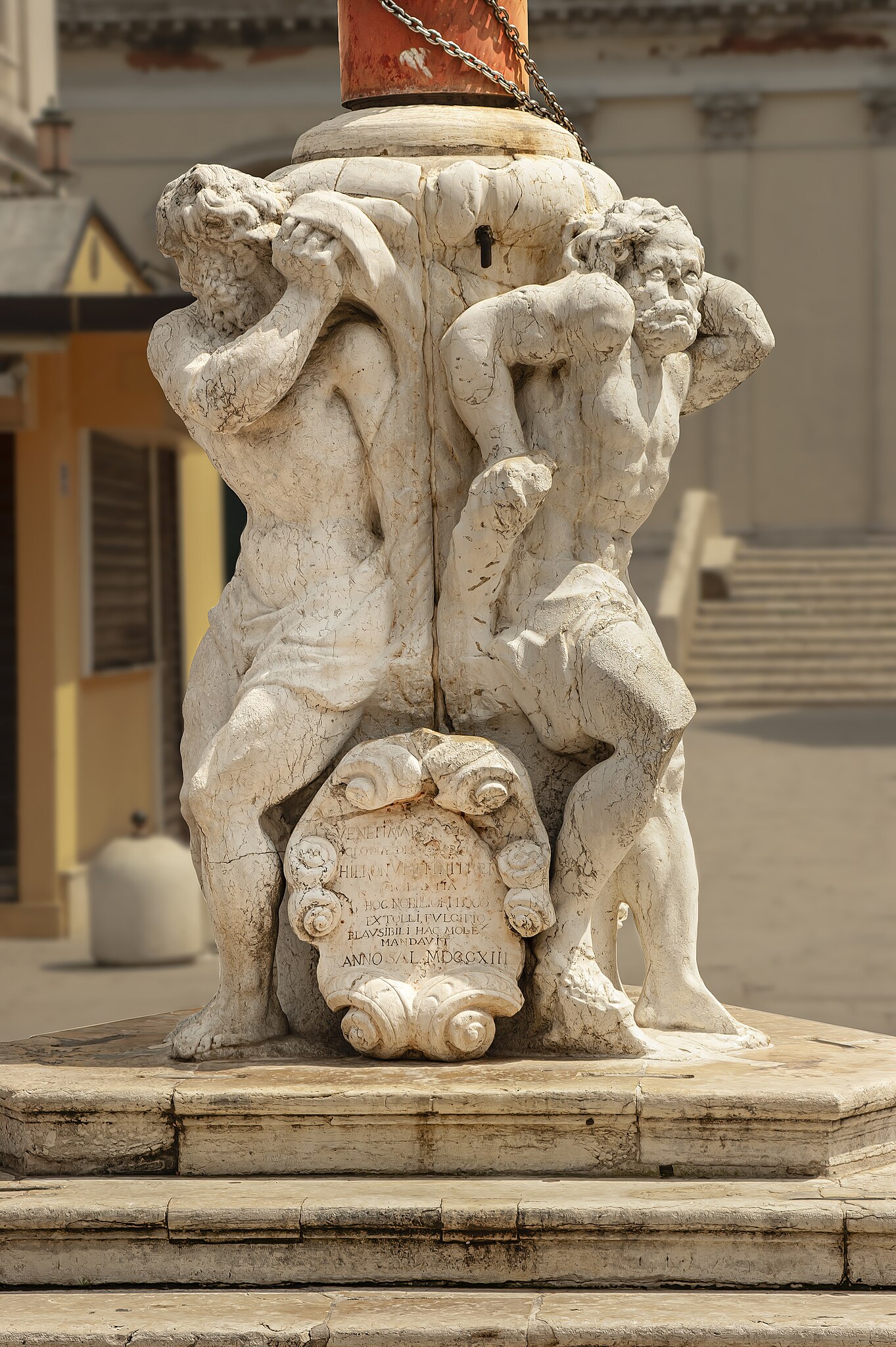
Chioggia - Telamoni - Corso del Popolo

VI seal

This image has been assessed under the valued image criteria and is considered the most valued image on Commons within the scope: Chioggia - Telamoni by Gioseffo Zemignani - Corso del Popolo. You can see its nomination here.

Description
English: Chioggia - Telamons, Corso del Popolo. Marble group with three Telamons that form the basis for the flagpole or city banner. The plastic work is by Gioseffo Zemignani (Geminiani), 1713.
Français : Chioggia - Télamons, Corso del Popolo. Groupe de marbre avec trois télamons qui forment la base du mât de la bannière de la ville. L'œuvre est de Gioseffo Zemignani (Geminiani) en 1713.
Italiano: Chioggia - Telamoni, Corso del Popolo. Gruppo marmoreo con tre Telamoni che fanno da base per il pennone portabandiera o Stendardo cittadino. L’opera plastica è delloGioseffo Zemignani (Geminiani), 1713. Qui fu innalzato il primo tricolore e durante il governo degli Austriaci si ebbe l'audacia di far sevntolare la bandiera italiana mentre le sentinelle erano mezze addormentate.
Date Taken on 9 May 2010
Source Own work
Author Didier Descouens
Permission
(Reusing this file)
This file is copyrighted and has been released under a license which is incompatible with Facebook's licensing terms. It is not permitted to upload this file at Facebook.
I, the copyright holder of this work, hereby publish it under the following license:
w:en:Creative Commons
attribution share alike
This file is licensed under the Creative Commons Attribution-Share Alike 4.0 International license.
You are free:
  • to share – to copy, distribute and transmit the work
  • to remix – to adapt the work
Under the following conditions:
  • attribution – You must give appropriate credit, provide a link to the license, and indicate if changes were made. You may do so in any reasonable manner, but not in any way that suggests the licensor endorses you or your use.
  • share alike – If you remix, transform, or build upon the material, you must distribute your contributions under the same or compatible license as the original.
Object location45° 12′ 59.46″ N, 12° 16′ 37.74″ E Kartographer map based on OpenStreetMap.View this and other nearby images on: OpenStreetMapinfo

Captions

Add a one-line explanation of what this file represents

Items portrayed in this file

depicts

9 May 2010

45°12'59.45876313749"N, 12°16'37.74522018531"E

0.00125 second

70 millimetre

image/jpeg

1d1257f6909174a3f4d4a52a72e1f122204085b3

26,545,406 byte

9,184 pixel

6,112 pixel

File history

Click on a date/time to view the file as it appeared at that time.

Date/TimeThumbnailDimensionsUserComment
current19:13, 27 December 2020Thumbnail for version as of 19:13, 27 December 20206,112 × 9,184 (25.32 MB)Archaeodontosaurus{{Information |Description= |Source={{own}} |Date= |Author= Archaeodontosaurus |Permission= |other_versions= }}
The following pages on the English Wikipedia use this file (pages on other projects are not listed):

Global file usage

The following other wikis use this file:

Metadata