
File:-2020-10-18 Gunton Hall, Hanworth, Norfolk (4).JPG
Size of this preview: 800 × 600 pixels. Other resolutions: 320 × 240 pixels | 640 × 480 pixels | 1,024 × 768 pixels | 1,280 × 960 pixels | 2,560 × 1,920 pixels | 5,152 × 3,864 pixels.
Original file (5,152 × 3,864 pixels, file size: 5.74 MB, MIME type: image/jpeg)
| This is a file from the Wikimedia Commons. Information from its description page there is shown below. Commons is a freely licensed media file repository. You can help. |
Summary
| Description |
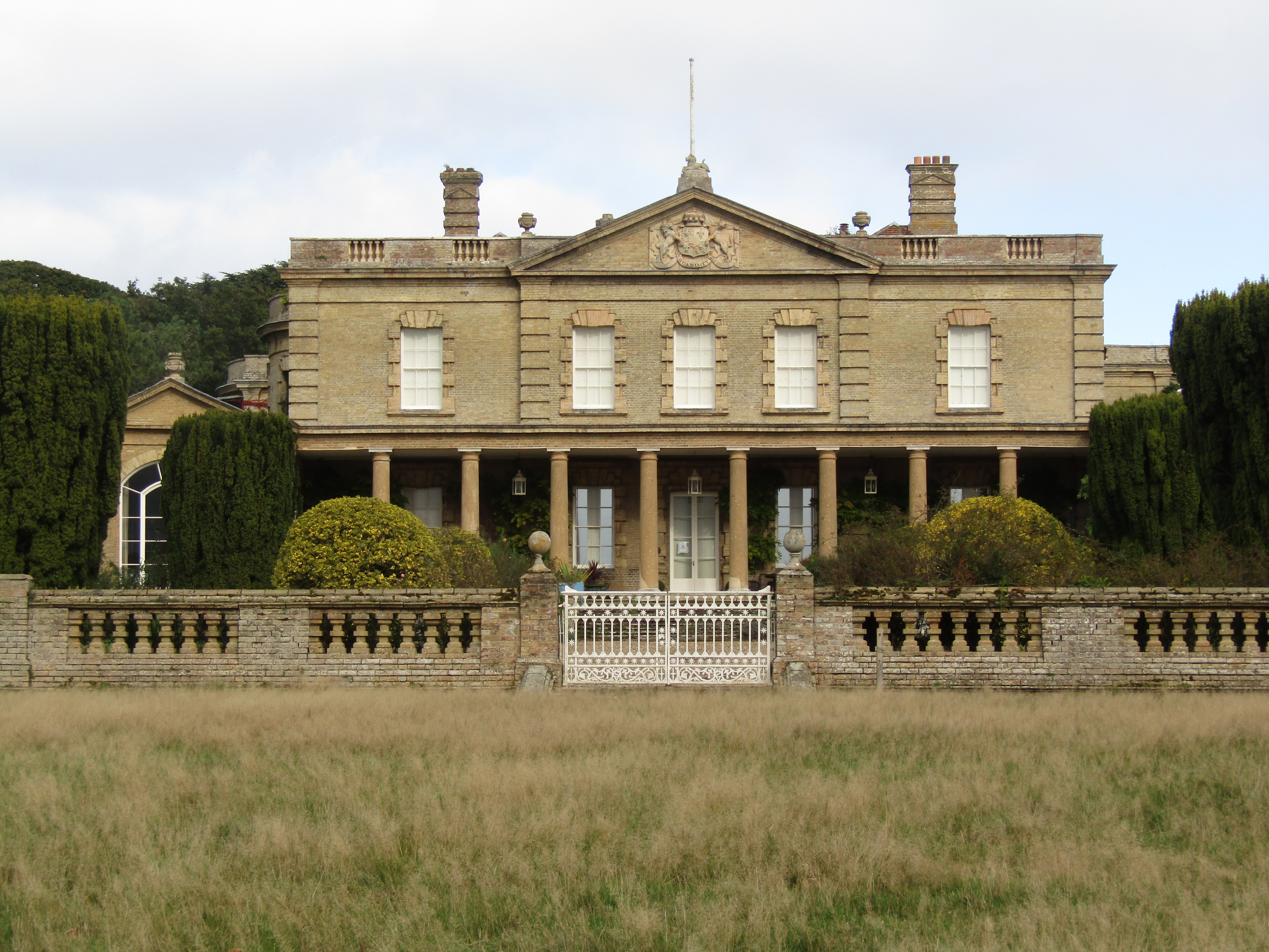
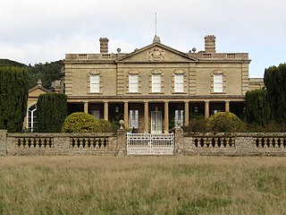
English: The south facing elevation of Gunton Hall which is located in the parish of Suffield, Norfolk, England. Gunton Hall is grade II* listed building. |
|
| Date |
Taken on 18 October 2020 Português: tirada a 18 de Outubro de 2020 |
|
| Source | Own work | |
| Author |
This file is licensed under the Creative Commons Attribution-Share Alike 4.0 International license.
|

.JPG)
| Camera location | | View this and other nearby images on: OpenStreetMap |
|---|
.JPG¶ms=052.857284_N_0001.307499_E_globe:Earth_type:camera__&language=en)
| Object location | | View this and other nearby images on: OpenStreetMap |
|---|
.JPG¶ms=052.858150_N_0001.307585_E_globe:Earth_class:object_type:object__&language=en)

|
The copyright holder of this file, Kolforn (Wikimedia), allows anyone to use it for any purpose, provided that the copyright holder is properly attributed. Redistribution, derivative work, commercial use, and all other use is permitted. |
Attribution:
Kolforn (Wikimedia)
|
File history
Click on a date/time to view the file as it appeared at that time.
| Date/Time | Thumbnail | Dimensions | User | Comment | |
|---|---|---|---|---|---|
| current | 09:32, 21 October 2020 | | 5,152 × 3,864 (5.74 MB) | Kolforn | {{Information |Description={{en|1=The south facing elevation of Gunton Hall which is located in the parish of {{w| Suffield, Norfolk }}, England. Gunton Hall is grade II* listed building.}} |Source={{own}} |Date={{Taken on|2020-10-18|location=United Kingdom}}{{pt|tirada a 18 de Outubro de 2020}} |Author={{User:Kolforn/Credit}} |Permission= |other_versions= }} {{Location dec|52.857284|1.307499}} {{Object location dec|52.858150|1.307585}} {{attribution|nolink=Kolforn (Wikimedia)}} [[Category... |
File usage
The following pages on the English Wikipedia use this file (pages on other projects are not listed):
Global file usage
The following other wikis use this file:
- Usage on fr.wikipedia.org
- Usage on www.wikidata.org
.JPG)