
File:07-1 Hindens rev – där istiden tog slut.jpg
Original file (3,151 × 4,260 pixels, file size: 6.15 MB, MIME type: image/jpeg)
| This is a file from the Wikimedia Commons. Information from its description page there is shown below. Commons is a freely licensed media file repository. You can help. |
Summary
| Description |
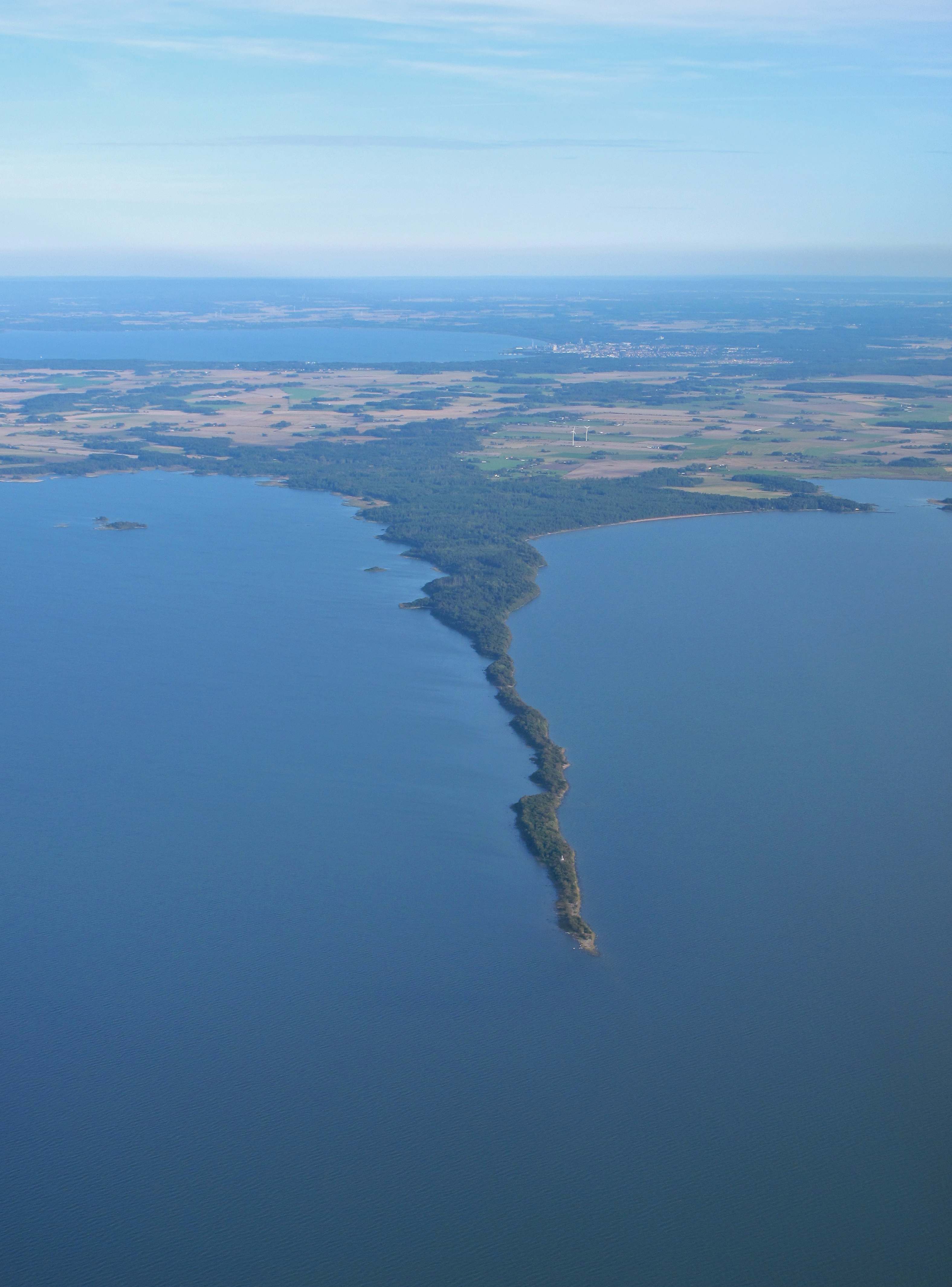
Svenska: Foto: Jesper Linder
Som en lång udde kan moränryggen följas ut i Vänern, och den fortsätter under vattenytan till andra sidan sjön. Revet, som egentligen är en ändmorän, bildades under ett ovanligt långt stillestånd av inlandsisens tillbakasmältande för 12 500 – 11 500 år sedan. Stilleståndet berodde på en sista ordentlig köldperiod under istidens slutskede. Ändmoränen ingår i en lång serie av ryggar som kan följas även i Norge och Finland och markerar slutet på istiden. Klimatet blev då snabbt varmare och isen smälte bort. Här utanför Lidköping syns ryggen mycket tydligt som ett långt smalt näs ut i Vänern. Koordinater: Sweref 6494396, 378682 Läs mer och rösta på www.sgu.se |
| Date | |
| Source | 07-1 Hindens rev – där istiden tog slut |
| Author | Geological Survey of Sweden SGU from Sweden |
| Camera location | | View this and other nearby images on: OpenStreetMap |
|---|
Licensing
- You are free:
- to share – to copy, distribute and transmit the work
- to remix – to adapt the work
- Under the following conditions:
- attribution – You must give appropriate credit, provide a link to the license, and indicate if changes were made. You may do so in any reasonable manner, but not in any way that suggests the licensor endorses you or your use.
| This image was originally posted to Flickr by Geological Survey of Sweden at https://flickr.com/photos/55118510@N03/7315756774. It was reviewed on 23 April 2016 by FlickreviewR and was confirmed to be licensed under the terms of the cc-by-2.0. |
File history
Click on a date/time to view the file as it appeared at that time.
| Date/Time | Thumbnail | Dimensions | User | Comment | |
|---|---|---|---|---|---|
| current | 19:25, 23 April 2016 | | 3,151 × 4,260 (6.15 MB) | Blue Elf | {{Information |Description={{sv|Foto: Jesper Linder Som en lång udde kan moränryggen följas ut i Vänern, och den fortsätter under vattenytan till andra sidan sjön. Revet, som egentligen är en ändmorän, bildades under ett ovanligt långt stil... |
File usage
Global file usage
The following other wikis use this file:
- Usage on arz.wikipedia.org
- Usage on ceb.wikipedia.org
- Usage on fi.wikipedia.org
- Usage on uk.wikipedia.org
- Usage on www.wikidata.org