File:A New Map of Ireland Divided into its Provinces, Counties and Baronies, wherein are distinguished the Bishopricks, Borroughs, Barracks, Bogs, Passes, Bridges, &c. with the Principal Roads, and the common Reputed... - btv1b53057272q.jpg

Original file (7,946 × 12,745 pixels, file size: 17.39 MB, MIME type: image/jpeg)
| This is a file from the Wikimedia Commons. Information from its description page there is shown below. Commons is a freely licensed media file repository. You can help. |
Summary
| Warning | The original file is very high-resolution. It might not load properly or could cause your browser to freeze when opened at full size. |
|---|
| Author |
creator QS:P170,Q1610319 |
||||||||||||||||||||||||||
| Title |
English: A New Map of Ireland Divided into Its Provinces, Counties and Baronies, Wherein Are Distinguished the Bishopricks, Borroughs, Barracks, Bogs, Passes, Bridges &c. with the Principal Roads, and the Common Reputed Miles, According to the Newest and Most Exact Observations by Herman Moll Geographer |
||||||||||||||||||||||||||
| Description |
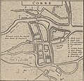
English: A map of British-occupied Ireland c. 1736 with bishoprics, cities, market towns, English estates, barracks, and fortifications, post and cross roads, ferries, bogs, and major sand bars along the Eastern shore marked. A chart on the bottom right lists the "troops" and companies of British soldiers stationed at various locations. Inset maps show the British Isles in Europe and detail maps of Dublin, Cork, Kinsale, Limrick, Waterford, Galway, the island of St. Patrick's Purgatory, and the area around the Giant's Causeway.
Français : Sujet : Armoiries
Irlande, Royaume d' -- Divisions politiques et administratives Irlande, Île d' Waterford Galway Kinsale Limerick Dublin Cork Géants, Chaussée des Échelle(s) : [1:555 000 environ], 30 Miles of Great Britain 60 in one Degree [= 9,9 cm] Appartient à l’ensemble documentaire : AnvilEur Appartient à l’ensemble documentaire : MAEDI008 Appartient à l’ensemble documentaire : MAEDIGen0 Couverture : Irlande Royaume-Uni – Irlande du Nord Langue : anglais |
||||||||||||||||||||||||||
| Date |
1714 date QS:P571,+1714-00-00T00:00:00Z/9 |
||||||||||||||||||||||||||
| Dimensions |
height: 64 cm (25.1 in); width: 105 cm (41.3 in) dimensions QS:P2048,64U174728 dimensions QS:P2049,105U174728 |
||||||||||||||||||||||||||
| Collection |
institution QS:P195,Q193563 |
||||||||||||||||||||||||||
| References |
Français : Notice de recueil : http://catalogue.bnf.fr/ark:/12148/cb40577015h
Appartient à : Collection d'Anville ; 02633 B Notice du catalogue : http://catalogue.bnf.fr/ark:/12148/cb406183087 |
||||||||||||||||||||||||||
| Source/Photographer |
Français : Bibliothèque nationale de France, département Cartes et plans, GE DD-2987 (2633 B)
Bibliothèque nationale de France |
||||||||||||||||||||||||||
| Permission (Reusing this file) |
|
||||||||||||||||||||||||||
| Other versions |
|
||||||||||||||||||||||||||
Captions
Items portrayed in this file
depicts
image/jpeg
be3aac8c4249962c8af5c891dc9dc66458fd44c2
18,238,303 byte
12,745 pixel
7,946 pixel
File history
Click on a date/time to view the file as it appeared at that time.
| Date/Time | Thumbnail | Dimensions | User | Comment | |
|---|---|---|---|---|---|
| current | 22:52, 23 July 2022 |  | 7,946 × 12,745 (17.39 MB) | Gzen92Bot | Gallica btv1b53057272q |


