
File:Admiralty Chart No 2759b Australia (Southern Portion) Compiled from the latest information in the Hydrographic Office, Published 1885, Corrections to 1896.jpg

Size of this preview: 800 × 530 pixels. Other resolutions: 320 × 212 pixels | 640 × 424 pixels | 1,024 × 679 pixels | 1,280 × 848 pixels | 2,560 × 1,697 pixels | 7,964 × 5,278 pixels.
Original file (7,964 × 5,278 pixels, file size: 5.05 MB, MIME type: image/jpeg)
| This is a file from the Wikimedia Commons. Information from its description page there is shown below. Commons is a freely licensed media file repository. You can help. |
_Compiled_from_the_latest_information_in_the_Hydrographic_Office,_Published_1885,_Corrections_to_1896.jpg)
Summary
| Description |
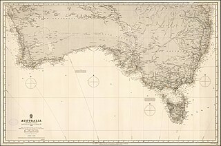
English: 1884 Admiralty Chart - Australia (Southern Portion) Compiled from the latest information in the Hydrographic Office |
||||||||||
| Date | |||||||||||
| Source | https://www.raremaps.com/gallery/detail/40595/australia-southern-portion-compiled-from-the-latest-inform-british-admiralty | ||||||||||
| Creator |
|
||||||||||
| Georeferencing | |||||||||||
Licensing
This work created by the United Kingdom Government is in the public domain.
This is because it is one of the following:
HMSO has declared that the expiry of Crown Copyrights applies worldwide (ref: HMSO Email Reply)
|
 |
File history
Click on a date/time to view the file as it appeared at that time.
| Date/Time | Thumbnail | Dimensions | User | Comment | |
|---|---|---|---|---|---|
| current | 10:02, 28 March 2020 | | 7,964 × 5,278 (5.05 MB) | Balkanique | Uploaded a work by British Admiralty from https://www.raremaps.com/gallery/detail/40595/australia-southern-portion-compiled-from-the-latest-inform-british-admiralty with UploadWizard |
File usage
The following pages on the English Wikipedia use this file (pages on other projects are not listed):
Global file usage
The following other wikis use this file:
- Usage on ha.wikipedia.org
- Usage on www.wikidata.org
_Compiled_from_the_latest_information_in_the_Hydrographic_Office,_Published_1885,_Corrections_to_1896.jpg)