
File:Al-Anbar map.svg

Size of this PNG preview of this SVG file: 589 × 600 pixels. Other resolutions: 236 × 240 pixels | 471 × 480 pixels | 754 × 768 pixels | 1,005 × 1,024 pixels | 2,011 × 2,048 pixels | 1,241 × 1,264 pixels.
Original file (SVG file, nominally 1,241 × 1,264 pixels, file size: 304 KB)
| This is a file from the Wikimedia Commons. Information from its description page there is shown below. Commons is a freely licensed media file repository. You can help. |
Summary
| Description |
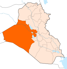
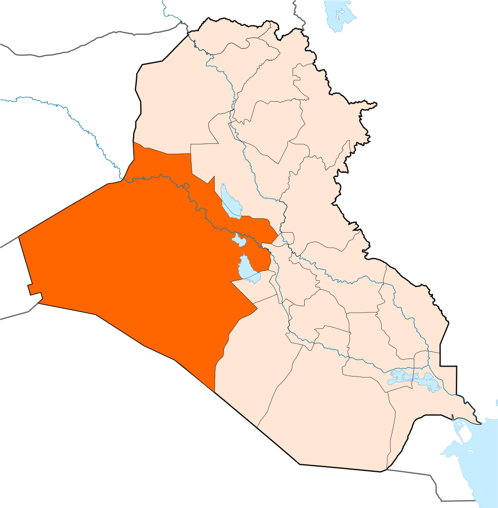
English: Map of Al-Anbar Province |
| Date | |
| Source |
Own work This vector image includes elements that have been taken or adapted from this file: |
| Author | Rafy |
Licensing
I, the copyright holder of this work, hereby publish it under the following licenses:

|
Permission is granted to copy, distribute and/or modify this document under the terms of the GNU Free Documentation License, Version 1.2 or any later version published by the Free Software Foundation; with no Invariant Sections, no Front-Cover Texts, and no Back-Cover Texts. A copy of the license is included in the section entitled GNU Free Documentation License. |
This file is licensed under the Creative Commons Attribution-Share Alike 3.0 Unported license.
- You are free:
- to share – to copy, distribute and transmit the work
- to remix – to adapt the work
- Under the following conditions:
- attribution – You must give appropriate credit, provide a link to the license, and indicate if changes were made. You may do so in any reasonable manner, but not in any way that suggests the licensor endorses you or your use.
- share alike – If you remix, transform, or build upon the material, you must distribute your contributions under the same or compatible license as the original.
You may select the license of your choice.
File history
Click on a date/time to view the file as it appeared at that time.
| Date/Time | Thumbnail | Dimensions | User | Comment | |
|---|---|---|---|---|---|
| current | 14:30, 17 June 2014 | | 1,241 × 1,264 (304 KB) | Kathovo | Reverted to version as of 12:22, 27 January 2011 |
| 01:59, 13 June 2014 |  | 1,241 × 1,264 (316 KB) | Spesh531 | with black outline | |
| 01:50, 13 June 2014 |  | 1,241 × 1,264 (316 KB) | Spesh531 | with halabja | |
| 12:22, 27 January 2011 |  | 1,241 × 1,264 (304 KB) | Kathovo | {{Information |Description ={{en|1=Al-Anbar map}} |Source ={{own}} |Author =Rafy |Date = |Permission = |other_versions = }} Category:Al Anbar Province |
File usage
The following pages on the English Wikipedia use this file (pages on other projects are not listed):
- Akashat
- Al-Karmah
- Al-Karābilah
- Al-Khalidiya, Iraq
- Al-Qa'im (town)
- Al Anbar Governorate
- Al Ubaidi
- Al Waleed border crossing
- Amiriyah Fallujah
- Anah
- Ar-Rutbah
- Ar Rahaliyah
- Barwanah
- Fallujah
- Habbaniyah
- Haditha
- Haqlaniyah
- Hit, Iraq
- Husaibah Al Sharqiah
- Husaybah
- Kabisa
- Khan al Baghdadi
- Nukhayb
- Ramadi
- Rawa, Iraq
- Rumana subdistrict
- Saqlawiyah
- Trebil
- Template:Al Anbar cities
Global file usage
The following other wikis use this file:
- Usage on ar.wikipedia.org
- محافظة الأنبار
- الفلوجة
- الرمادي
- راوة
- عانة (العراق)
- هيت
- الحبانية
- النخيب
- الخالدية (الأنبار)
- قالب:مدن الأنبار
- الرطبة
- الحقلانية
- الرحالية
- حديثة (الأنبار)
- كبيسة
- الكرمة (العراق)
- بروانة
- الثرثار (مدينة)
- عكاشات
- طريبيل
- القعقاء
- ناحية الوليد
- البتراء (العراق)
- الأوسط
- الصقلاوية
- الرمانة (مدينة)
- المعمورة (القائم)
- الكرابلة (مدينة)
- العبيدي (مدينة)
- جبة (العراق)
- حصيبة الشرقية
- عامرية الفلوجة
- السجر
- الساجرية
- الهبارية (العراق)
- الكسرة (الأنبار)
- الفرات (ناحية)
- المحمدي (ناحية)
- الريحانة (العراق)
- الحميرية (ناحية)
- النهيدين
- الجزيرة (ناحية)
- قضاء العامرية
- آلوس
- الصوفية (ناحية)
- الشهابي (الأنبار)
- سكنية الثرثار
- القائم (مدينة)
- قالب:مدن محافظة الأنبار
- حرب العراق بمحافظة الأنبار
View more global usage of this file.