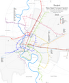
File:Bangkok Mass Rapid Transit Map.png

Size of this preview: 505 × 599 pixels. Other resolutions: 202 × 240 pixels | 404 × 480 pixels | 647 × 768 pixels | 863 × 1,024 pixels | 1,726 × 2,048 pixels | 3,609 × 4,282 pixels.
Original file (3,609 × 4,282 pixels, file size: 2.74 MB, MIME type: image/png)
File history
Click on a date/time to view the file as it appeared at that time.
| Date/Time | Thumbnail | Dimensions | User | Comment | |
|---|---|---|---|---|---|
| current | 03:31, 14 December 2023 |  | 3,609 × 4,282 (2.74 MB) | Nord794ub | pink line in action |
| 00:04, 31 July 2023 |  | 3,609 × 4,282 (2.76 MB) | Nord794ub | ||
| 00:48, 20 June 2023 |  | 3,609 × 4,282 (2.75 MB) | Nord794ub | Yellow line now open | |
| 03:50, 14 June 2023 |  | 3,609 × 4,282 (2.76 MB) | Nord794ub | Error fix with great help by Packi124 | |
| 06:50, 11 February 2023 |  | 3,609 × 4,282 (2.75 MB) | Nord794ub | New west orange line extension | |
| 17:53, 8 February 2023 |  | 3,609 × 4,282 (2.71 MB) | Nord794ub | new Pink annex and small improvements | |
| 06:03, 6 February 2023 |  | 3,609 × 4,282 (2.69 MB) | Nord794ub | Major update - new colors, new ARL extension, Elevated or underground lines indication | |
| 10:14, 3 February 2023 |  | 3,609 × 4,282 (2.41 MB) | Nord794ub | SRT station changes | |
| 09:58, 30 January 2023 |  | 3,608 × 4,282 (1.71 MB) | Nord794ub | Actual status of suspended lines | |
| 14:58, 21 May 2022 |  | 3,609 × 4,282 (2.41 MB) | Nord794ub | new boat roads, small improvements |
File usage
The following pages on the English Wikipedia use this file (pages on other projects are not listed):
Global file usage
The following other wikis use this file:
- Usage on eo.wikipedia.org
- Usage on es.wikipedia.org
- Usage on ru.wikipedia.org
- Бангкок
- Метрополитены Бангкока
- Водный транспорт Бангкока
- Сукхумвит (линия метро, Бангкок)
- Силом (линия метро, Бангкок)
- Chaloem Ratchamongkhon (линия метро, Бангкок)
- Chalong Ratchadham (линия метро, Бангкок)
- BTS Skytrain (система метро, Бангкок)
- Airport Rail Link (линия метро, Бангкок)
- MRT (система метро, Бангкок)
- Шаблон:Общественный транспорт Бангкока
- Скоростной автобус Бангкока
- Водный автобус по каналу Пхасичарен
- Водный автобус по каналу Сэнсэп
- Gold line (линия метро, Бангкок)
- Mangmoom Card
- Bang Na–Suvarnabhumi Line
- MRT Yellow Line
- SRT Light Red Line
- Трамвай Бангкока
- Водный автобус по каналу Рангсит
- Водный автобус по реке Чаупхрая
- Mine Smart Ferry
- Бангсы (вокзал)
- MRT Pink Line
- MRT Orange Line
- SRT Dark Red Line
- MRT Brown Line
- MRT Grey Line
- Mass Rapid Transit Authority of Thailand
- Rabbit Card
- Usage on th.wikipedia.org

