
File:Barn by the Ridgeway at Chivery - geograph.org.uk - 1320670.jpg
No higher resolution available.
Barn_by_the_Ridgeway_at_Chivery_-_geograph.org.uk_-_1320670.jpg (640 × 480 pixels, file size: 107 KB, MIME type: image/jpeg)
| This is a file from the Wikimedia Commons. Information from its description page there is shown below. Commons is a freely licensed media file repository. You can help. |
Summary
| Description |
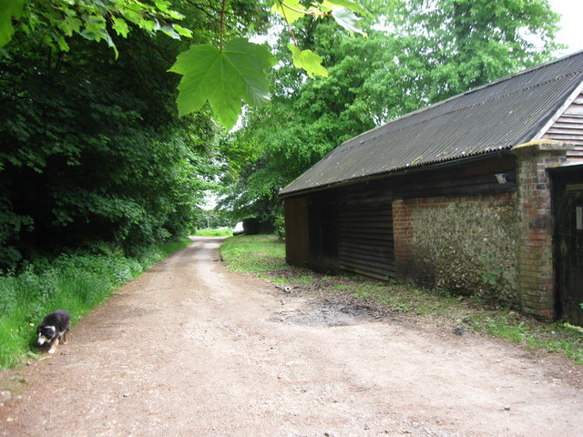
English: Barn by the Ridgeway at Chivery. The barn appears to be associated with the adjacent Hengrove Cottage.
The track is part of the Ridgeway long distance footpath and joins the road through Chivery at 1320516 - where the barn can be seen on the left. Historically the track is wider than it appears as an old bank can be seen a few yards into Hengrove Wood. It would seem to be an ancient droveway from the valley bottom at The Hale via a holloway to the Chiltern's top at Chivery. |
| Date | |
| Source | From geograph.org.uk |
| Author | Chris Reynolds |
| Attribution (required by the license) | Chris Reynolds / Barn by the Ridgeway at Chivery / |
| Camera location | | View this and other nearby images on: OpenStreetMap |
|---|
_heading:135.00&language=en)
| Object location | | View this and other nearby images on: OpenStreetMap |
|---|
_heading:135.00&language=en)
Licensing

|
This image was taken from the Geograph project collection. See this photograph's page on the Geograph website for the photographer's contact details. The copyright on this image is owned by Chris Reynolds and is licensed for reuse under the Creative Commons Attribution-ShareAlike 2.0 license.
|
This file is licensed under the Creative Commons Attribution-Share Alike 2.0 Generic license.
Attribution: Chris Reynolds
- You are free:
- to share – to copy, distribute and transmit the work
- to remix – to adapt the work
- Under the following conditions:
- attribution – You must give appropriate credit, provide a link to the license, and indicate if changes were made. You may do so in any reasonable manner, but not in any way that suggests the licensor endorses you or your use.
- share alike – If you remix, transform, or build upon the material, you must distribute your contributions under the same or compatible license as the original.
File history
Click on a date/time to view the file as it appeared at that time.
| Date/Time | Thumbnail | Dimensions | User | Comment | |
|---|---|---|---|---|---|
| current | 20:07, 27 February 2011 | | 640 × 480 (107 KB) | GeographBot | == {{int:filedesc}} == {{Information |description={{en|1=Barn by the Ridgeway at Chivery The barn appears to be associated with the adjacent Hengrove Cottage. The track is part of the Ridgeway long distance footpath and joins the road through Chivery at |
File usage
The following pages on the English Wikipedia use this file (pages on other projects are not listed):