
File:Batham gate.jpg
No higher resolution available.
Batham_gate.jpg (640 × 370 pixels, file size: 94 KB, MIME type: image/jpeg)
| This is a file from the Wikimedia Commons. Information from its description page there is shown below. Commons is a freely licensed media file repository. You can help. |
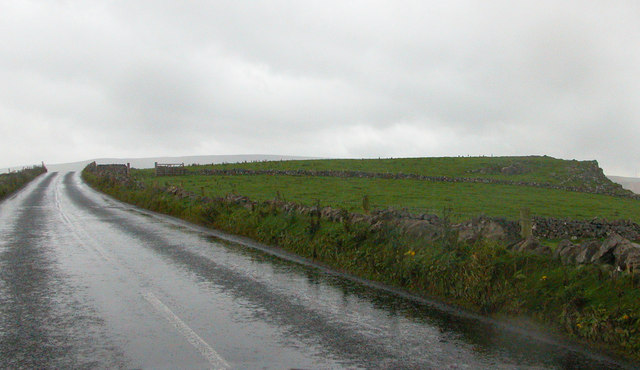
| Description | Batham Gate Roman road. Batham Gate is the Roman road from w:Buxton to the north-east. After climbing steeply up the hillside from Peak Dale the road descends gradually to the south of Peak Forest and on to Castleton. At the point in the photograph it is passing Laughman Tor. |
| Date | |
| Source | From geograph.org.uk |
| Author | Roger Temple |
| Permission (Reusing this file) |
Creative Commons Attribution Share-alike license 2.0 |
| Attribution (required by the license) | Roger Temple / Batham Gate Roman road / |
| Camera location | | View this and other nearby images on: OpenStreetMap |
|---|

|
This image was taken from the Geograph project collection. See this photograph's page on the Geograph website for the photographer's contact details. The copyright on this image is owned by Roger Temple and is licensed for reuse under the Creative Commons Attribution-ShareAlike 2.0 license.
|
This file is licensed under the Creative Commons Attribution-Share Alike 2.0 Generic license.
Attribution: Roger Temple
- You are free:
- to share – to copy, distribute and transmit the work
- to remix – to adapt the work
- Under the following conditions:
- attribution – You must give appropriate credit, provide a link to the license, and indicate if changes were made. You may do so in any reasonable manner, but not in any way that suggests the licensor endorses you or your use.
- share alike – If you remix, transform, or build upon the material, you must distribute your contributions under the same or compatible license as the original.
File history
Click on a date/time to view the file as it appeared at that time.
| Date/Time | Thumbnail | Dimensions | User | Comment | |
|---|---|---|---|---|---|
| current | 21:53, 13 December 2008 | | 640 × 370 (94 KB) | Victuallers | {{Information |Description=Batham Gate Roman road. Batham Gate is the Roman road from w:Buxton to the north-east. After climbing steeply up the hillside from Peak Dale the road descends gradually to the south of Peak Forest and on to Castleton. At the |
File usage
The following pages on the English Wikipedia use this file (pages on other projects are not listed):
Global file usage
The following other wikis use this file:
- Usage on cs.wikipedia.org
- Usage on it.wikipedia.org
- Usage on la.wikipedia.org
- Usage on www.wikidata.org