
File:Blaeu - Atlas of Scotland 1654 - LORNA - The Firth of Lorn.jpg
Size of this preview: 800 × 597 pixels. Other resolutions: 320 × 239 pixels | 640 × 477 pixels | 1,024 × 764 pixels | 1,280 × 955 pixels | 2,560 × 1,910 pixels | 6,333 × 4,725 pixels.
Original file (6,333 × 4,725 pixels, file size: 6.15 MB, MIME type: image/jpeg)
| This is a file from the Wikimedia Commons. Information from its description page there is shown below. Commons is a freely licensed media file repository. You can help. |
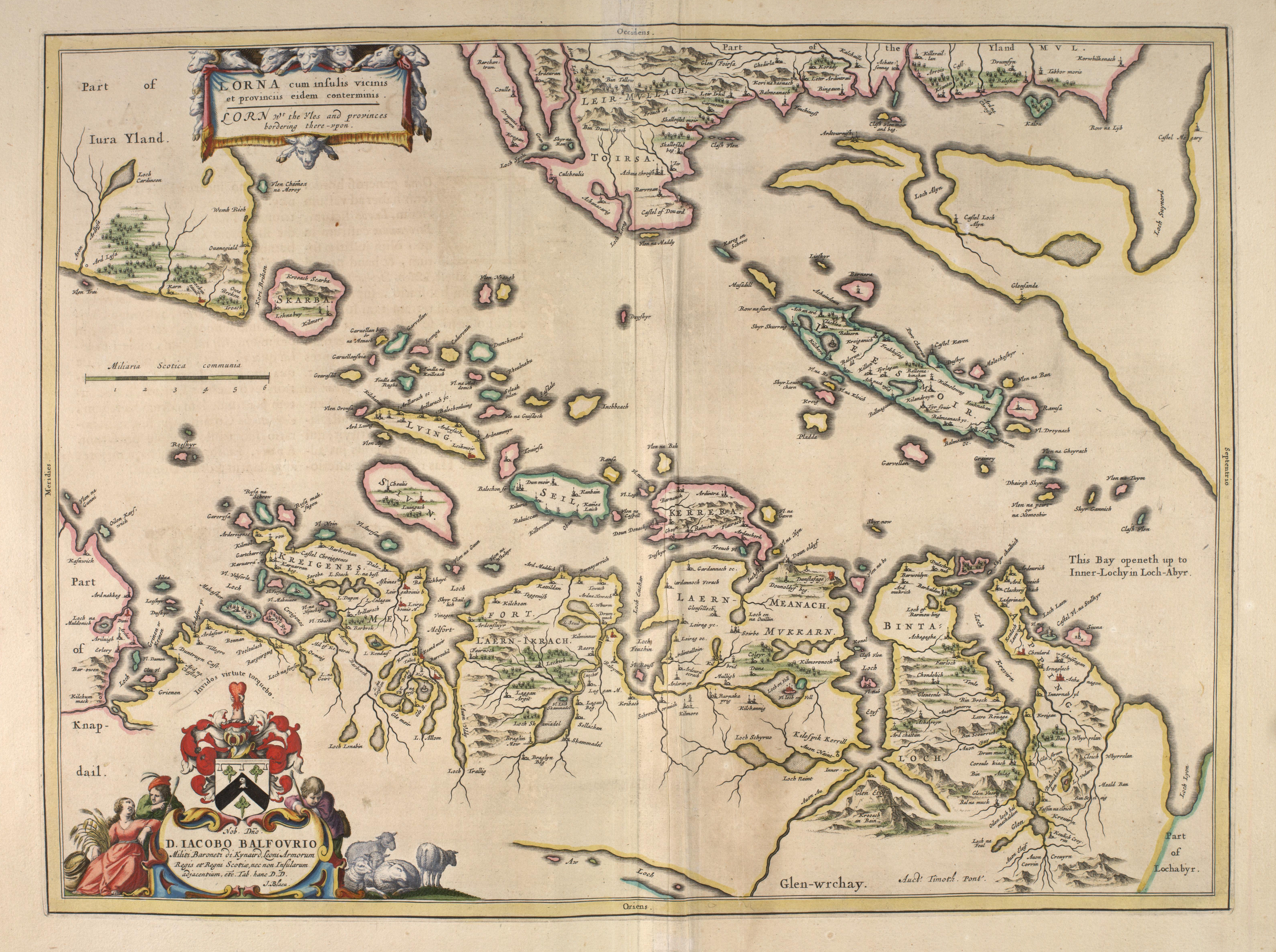
| Description | LORNA - The Firth of Lorn | |||
| Date | ||||
| Source |
|
|||
| Author | Blaeu | |||
| Permission (Reusing this file) |
Public domain (70 years post mortem auctoris) |


|
This work is in the public domain in its country of origin and other countries and areas where the copyright term is the author's life plus 100 years or fewer. | |
| This file has been identified as being free of known restrictions under copyright law, including all related and neighboring rights. | |
File history
Click on a date/time to view the file as it appeared at that time.
| Date/Time | Thumbnail | Dimensions | User | Comment | |
|---|---|---|---|---|---|
| current | 16:12, 17 June 2007 | | 6,333 × 4,725 (6.15 MB) | Simplicius | {{Information |Description=LORNA - The Firth of Lorn |Source=[http://www.nls.uk/maps/early/blaeu/blaeu_maps_index.html National Library of Scotland] |Date=1654 |Author=Blaeu |Permission=Public domain (70 years post mortem auctoris) |other_versions= }} |
File usage
The following pages on the English Wikipedia use this file (pages on other projects are not listed):