
File:Brand Building, 120-124 Saint Clair Street, Toledo (Lucas County, Ohio).jpg
No higher resolution available.
Brand_Building,_120-124_Saint_Clair_Street,_Toledo_(Lucas_County,_Ohio).jpg (449 × 551 pixels, file size: 76 KB, MIME type: image/jpeg)
| This is a file from the Wikimedia Commons. Information from its description page there is shown below. Commons is a freely licensed media file repository. You can help. |
|
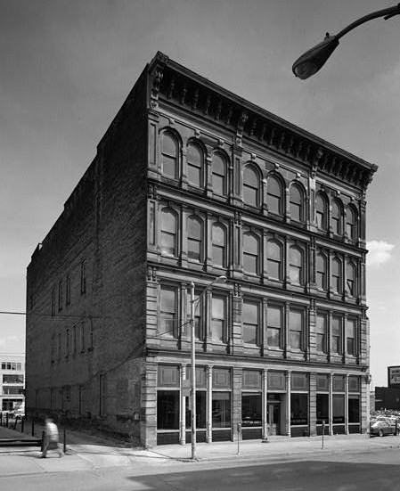
This is an image of a place or building that is listed on the National Register of Historic Places in the United States of America. Its reference number is 75001469. |
| Description |
English: Brand Building, 120-124 Saint Clair Street, Toledo (Lucas County, Ohio) - cropped
|
||||||||
| Date | |||||||||
| Source | http://memory.loc.gov/cgi-bin/displayPhoto.pl?path=/pnp/habshaer/oh/oh0000/oh0098/photos&topImages=127987pr.jpg&topLinks=127987pv.jpg,127987pu.tif&title=1.%20%20FRONT%20ELEVATION,%20VIEW%20SOUTH%20%3cbr%3eHABS%20OHIO,48-TOLED,7-1&displayProfile=0 | ||||||||
| Author | R. A. Benton, Photographer |


.jpg)
| Object location | | View this and other nearby images on: OpenStreetMap |
|---|
.jpg¶ms=041.649167_N_-083.536111_E_globe:Earth_class:object_region:US_type:landmark_scale:1500_&language=en)
File history
Click on a date/time to view the file as it appeared at that time.
| Date/Time | Thumbnail | Dimensions | User | Comment | |
|---|---|---|---|---|---|
| current | 20:34, 2 May 2009 | | 449 × 551 (76 KB) | KudzuVine | {{Information |Description={{en|1=Brand Building, 120-124 Saint Clair Street, Toledo (Lucas County, Ohio) - cropped {{HABS|OHIO,48-TOLED,7-1}} {{PD-USGov-Interior}} }} |Source=http://memory.loc.gov/cgi-bin/displayPhoto.pl?path=/pnp/habshaer/oh/oh0000/oh00 |
File usage
The following pages on the English Wikipedia use this file (pages on other projects are not listed):
.jpg)