
File:Bridge No 1, Trent and Mersey Canal near Shardlow - geograph.org.uk - 1618653.jpg
No higher resolution available.
Bridge_No_1,_Trent_and_Mersey_Canal_near_Shardlow_-_geograph.org.uk_-_1618653.jpg (640 × 442 pixels, file size: 121 KB, MIME type: image/jpeg)
| This is a file from the Wikimedia Commons. Information from its description page there is shown below. Commons is a freely licensed media file repository. You can help. |
Summary
| Description |
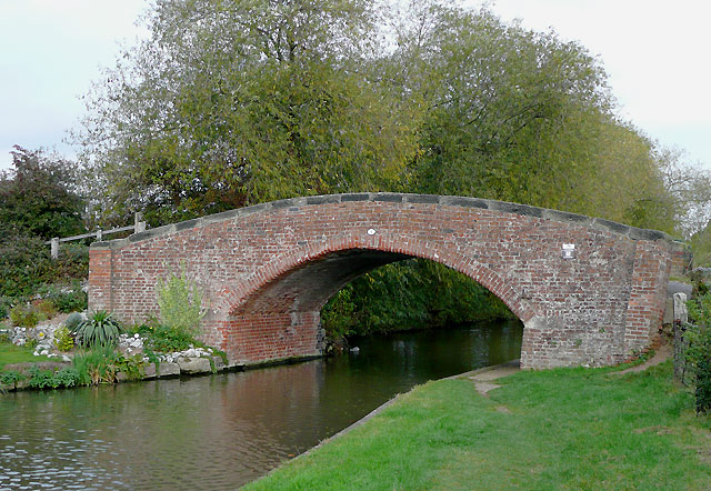
English: Bridge No 1, Trent and Mersey Canal near Shardlow. About six hundred metres ahead the canal joins the River Trent. James Brindley started work engineering this canal in 1766, though the complete cut to Preston Brook near Runcorn was finally opened in 1777, five years after his death. The section here, from Derwent Mouth and through Shardlow was operating by 1770. |
| Date | |
| Source | From geograph.org.uk |
| Author | Roger Kidd |
| Attribution (required by the license) | Roger Kidd / Bridge No 1, Trent and Mersey Canal near Shardlow / |
This is a photo of listed building number 1205342. |
| Camera location | | View this and other nearby images on: OpenStreetMap |
|---|
_heading:67.00&language=en)
| Object location | | View this and other nearby images on: OpenStreetMap |
|---|
_heading:67.00&language=en)
Licensing

|
This image was taken from the Geograph project collection. See this photograph's page on the Geograph website for the photographer's contact details. The copyright on this image is owned by Roger Kidd and is licensed for reuse under the Creative Commons Attribution-ShareAlike 2.0 license.
|
This file is licensed under the Creative Commons Attribution-Share Alike 2.0 Generic license.
Attribution: Roger Kidd
- You are free:
- to share – to copy, distribute and transmit the work
- to remix – to adapt the work
- Under the following conditions:
- attribution – You must give appropriate credit, provide a link to the license, and indicate if changes were made. You may do so in any reasonable manner, but not in any way that suggests the licensor endorses you or your use.
- share alike – If you remix, transform, or build upon the material, you must distribute your contributions under the same or compatible license as the original.
File history
Click on a date/time to view the file as it appeared at that time.
| Date/Time | Thumbnail | Dimensions | User | Comment | |
|---|---|---|---|---|---|
| current | 09:09, 4 March 2011 | | 640 × 442 (121 KB) | GeographBot | == {{int:filedesc}} == {{Information |description={{en|1=Bridge No 1, Trent and Mersey Canal near Shardlow About six hundred metres ahead the canal joins the River Trent. James Brindley started work engineering this canal in 1766, though the complete cut |
File usage
The following pages on the English Wikipedia use this file (pages on other projects are not listed):