
File:Brno (formerly Masarykův okruh).svg

Size of this PNG preview of this SVG file: 800 × 460 pixels. Other resolutions: 320 × 184 pixels | 640 × 368 pixels | 1,024 × 588 pixels | 1,280 × 735 pixels | 2,560 × 1,471 pixels | 1,394 × 801 pixels.
Original file (SVG file, nominally 1,394 × 801 pixels, file size: 34 KB)
| This is a file from the Wikimedia Commons. Information from its description page there is shown below. Commons is a freely licensed media file repository. You can help. |
.svg)
Summary
| Description |
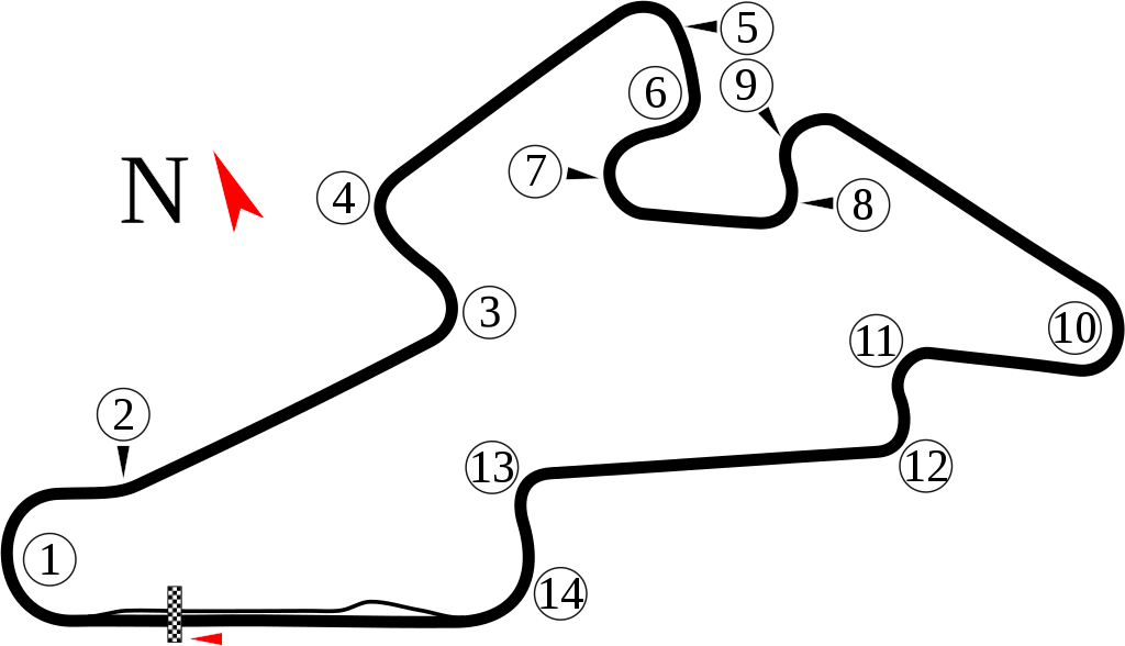
English: Track map of Brno (formerly Masarykův okruh) near Brno, Czech Republic.
Čeština: Mapa trať Brno (dříve Masarykův okruh) u Brna, Česká republika. |
| Date | 8-7-2008 |
| Source | Own work |
| Author | Will Pittenger |
This W3C-unspecified vector image was created with Inkscape .
| Camera location | | View this and other nearby images on: OpenStreetMap |
|---|
.svg¶ms=049.205000_N_0016.452417_E_globe:Earth_type:camera__&language=en)
Licensing
I, the copyright holder of this work, hereby publish it under the following license:
This file is licensed under the Creative Commons Attribution-Share Alike 3.0 Unported license.
- You are free:
- to share – to copy, distribute and transmit the work
- to remix – to adapt the work
- Under the following conditions:
- attribution – You must give appropriate credit, provide a link to the license, and indicate if changes were made. You may do so in any reasonable manner, but not in any way that suggests the licensor endorses you or your use.
- share alike – If you remix, transform, or build upon the material, you must distribute your contributions under the same or compatible license as the original.
File history
Click on a date/time to view the file as it appeared at that time.
| Date/Time | Thumbnail | Dimensions | User | Comment | |
|---|---|---|---|---|---|
| current | 05:43, 11 May 2020 | | 1,394 × 801 (34 KB) | Jirka.h23 | some numbers were not visible. |
| 05:32, 11 May 2020 |  | 1,394 × 801 (38 KB) | Jirka.h23 | It have only 14 corners. https://www.automotodrombrno.cz/en/about-circuit/track/ | |
| 08:39, 7 August 2008 |  | 1,394 × 801 (44 KB) | Will Pittenger | Once again, I didn't get the file saved. :( | |
| 08:37, 7 August 2008 |  | 1,394 × 801 (33 KB) | Will Pittenger | Made some stuff bigger and easier to see. | |
| 08:25, 7 August 2008 |  | 1,394 × 801 (33 KB) | Will Pittenger | Fixed bad clip | |
| 08:24, 7 August 2008 |  | 1,394 × 780 (33 KB) | Will Pittenger | Latest version wasn't saved when I uploaded. This is it. | |
| 08:22, 7 August 2008 |  | 1,394 × 780 (26 KB) | Will Pittenger | {{Information |Description={{en|1=Track map of Brno (formerly Masarykův okruh) near Brno, Czech Republic.}} |Source=Own work by uploader |Author=Will Pittenger |Date=8-7-2008 |Permission= |other_versions=<gal |
File usage
The following pages on the English Wikipedia use this file (pages on other projects are not listed):
- 1987 Czechoslovak motorcycle Grand Prix
- 1987 Grand Prix Brno
- 1988 360 km of Brno
- 1988 Czechoslovak motorcycle Grand Prix
- 1989 Czechoslovak motorcycle Grand Prix
- 1990 Czechoslovak motorcycle Grand Prix
- 1991 Czechoslovak motorcycle Grand Prix
- 1993 Czech Republic motorcycle Grand Prix
- 1994 Czech Republic motorcycle Grand Prix
- 1995 Czech Republic motorcycle Grand Prix
- 1996 Czech Republic motorcycle Grand Prix
- 1997 Czech Republic motorcycle Grand Prix
- 1997 International Sports Racing Series Brno
- 1998 Czech Republic motorcycle Grand Prix
- 1999 Czech Republic motorcycle Grand Prix
- 2000 Czech Republic motorcycle Grand Prix
- 2000 FIA GT Brno 500km
- 2001 Czech Republic motorcycle Grand Prix
- 2001 FIA GT Brno 500 km
- 2002 Czech Republic motorcycle Grand Prix
- 2002 FIA GT Brno 500km
- 2002 FIA Sportscar Championship Brno
- 2003 Czech Republic motorcycle Grand Prix
- 2003 FIA GT Brno 500km
- 2004 Czech Republic motorcycle Grand Prix
- 2004 FIA GT Brno 500km
- 2005 Brno DTM round
- 2005 Czech Republic motorcycle Grand Prix
- 2005 FIA GT Brno Supercar 500
- 2006 Brno Superbike World Championship round
- 2006 Czech Republic motorcycle Grand Prix
- 2006 FIA GT Brno 500km
- 2006–07 A1 Grand Prix of Nations, Czech Republic
- 2007 Brno Superbike World Championship round
- 2007 Czech Republic motorcycle Grand Prix
- 2007 FIA GT Brno 2 Hours
- 2007–08 A1 Grand Prix of Nations, Czech Republic
- 2008 Brno Superbike World Championship round
- 2008 Czech Republic motorcycle Grand Prix
- 2008 FIA GT Brno 2 Hours
- 2009 Brno Formula Two round
- 2009 Brno Superbike World Championship round
- 2009 Czech Republic motorcycle Grand Prix
- 2009 FIA WTCC Race of the Czech Republic
- 2010 Brno Formula Two round
- 2010 Brno Superbike World Championship round
- 2010 Czech Republic motorcycle Grand Prix
- 2010 FIA GT1 Brno round
- 2010 FIA WTCC Race of the Czech Republic
- 2011 Brno Superbike World Championship round
- 2011 Czech Republic motorcycle Grand Prix
- 2011 FIA WTCC Race of the Czech Republic
- 2012 Czech Republic motorcycle Grand Prix
- 2013 Czech Republic motorcycle Grand Prix
- 2014 Czech Republic motorcycle Grand Prix
- 2015 Czech Republic motorcycle Grand Prix
- 2016 Czech Republic motorcycle Grand Prix
- 2017 Czech Republic motorcycle Grand Prix
- 2018 Czech Republic motorcycle Grand Prix
- 2019 Czech Republic motorcycle Grand Prix
- 2020 Czech Republic motorcycle Grand Prix
- Brno 2 Hours 30 Minutes
- Brno Circuit
- Czech Republic motorcycle Grand Prix
- Czechoslovakian Grand Prix
- FIA WTCR Race of the Czech Republic
- List of A1 Grand Prix circuits
- List of FIA World Touring Car Championship circuits
- List of Grand Prix motorcycle circuits
- List of Superbike World Championship circuits
- List of World Sportscar Championship circuits
Global file usage
The following other wikis use this file:
- Usage on ar.wikipedia.org
- جائزة التشيك الكبرى للدراجات النارية 2006
- حلبة برنو
- جائزة التشيك الكبرى للدراجات النارية 1993
- جائزة التشيك الكبرى للدراجات النارية 1994
- جائزة التشيك الكبرى للدراجات النارية 1995
- جائزة التشيك الكبرى للدراجات النارية 1996
- جائزة التشيك الكبرى للدراجات النارية 1997
- جائزة التشيك الكبرى للدراجات النارية 1998
- جائزة التشيك الكبرى للدراجات النارية 1999
- جائزة التشيك الكبرى للدراجات النارية 2000
- جائزة التشيك الكبرى للدراجات النارية 2001
- جائزة التشيك الكبرى للدراجات النارية 2002
- جائزة التشيك الكبرى للدراجات النارية 2003
- جائزة التشيك الكبرى للدراجات النارية 2004
- جائزة التشيك الكبرى للدراجات النارية 2005
- جائزة التشيك الكبرى للدراجات النارية 2007
- جائزة التشيك الكبرى للدراجات النارية 2008
- جائزة التشيك الكبرى للدراجات النارية 2009
- جائزة التشيك الكبرى للدراجات النارية 2010
- جائزة التشيك الكبرى للدراجات النارية 2011
- جائزة التشيك الكبرى للدراجات النارية 2012
- جائزة التشيك الكبرى للدراجات النارية 2013
- جائزة التشيك الكبرى للدراجات النارية 2014
- جائزة التشيك الكبرى للدراجات النارية 2015
- جائزة التشيك الكبرى للدراجات النارية 2018
- جائزة التشيك الكبرى للدراجات النارية 2019
- Usage on ast.wikipedia.org
- Usage on ca.wikipedia.org
- Usage on cs.wikipedia.org
- Usage on de.wikipedia.org
- GTR (Computerspielreihe)
- Liste der DTM-Rennstrecken
- Automotodrom Brno
- Großer Preis von Tschechien (Motorrad)
- Liste der Tourenwagen-Weltmeisterschaft-Rennstrecken
- Motorrad-Weltmeisterschaft 2013
- Großer Preis der Tschechoslowakei (Motorrad)
- Motorrad-Weltmeisterschaft 2014
- Motorrad-Weltmeisterschaft 2015
- Benutzer:Saber-rider1/Vorbereitungen
- Benutzer:Saber-rider1/Vorbereitungen2
- Motorrad-Weltmeisterschaft 2016
- Red Bull MotoGP Rookies Cup 2007
- Red Bull MotoGP Rookies Cup 2008
- Red Bull MotoGP Rookies Cup 2009
View more global usage of this file.
.svg)
.svg)