
File:Buenos Aires Formula e.svg

Size of this PNG preview of this SVG file: 600 × 600 pixels. Other resolutions: 240 × 240 pixels | 480 × 480 pixels | 768 × 768 pixels | 1,024 × 1,024 pixels | 2,048 × 2,048 pixels | 1,150 × 1,150 pixels.
Original file (SVG file, nominally 1,150 × 1,150 pixels, file size: 93 KB)
| This is a file from the Wikimedia Commons. Information from its description page there is shown below. Commons is a freely licensed media file repository. You can help. |
Summary
| Description |
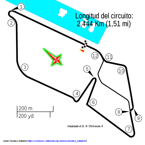
Español: Trazado del circuito de Fórmula E en Puerto Madero, Buenos Aires |
|||
| Date | ||||
| Source | openstreetmap.org | |||
| Creator |
OpenStreetMap contributors |
|||
| Permission (Reusing this file) |
OpenStreetMap data is available under the Open Database License (details). Map tiles are licensed under the Creative Commons Attribution-ShareAlike 2.0 license (CC-BY-SA 2.0).
This file is licensed under the Creative Commons Attribution-Share Alike 2.0 Generic license.
|
|||
| Georeferencing | If inappropriate please set warp_status = skip to hide. |
| Camera location | | View this and other nearby images on: OpenStreetMap |
|---|
File history
Click on a date/time to view the file as it appeared at that time.
| Date/Time | Thumbnail | Dimensions | User | Comment | |
|---|---|---|---|---|---|
| current | 18:33, 5 April 2015 | | 1,150 × 1,150 (93 KB) | Gustavo Girardelli | Agua. |
| 15:30, 7 October 2014 |  | 1,150 × 1,150 (97 KB) | Gustavo Girardelli | Nueva versión. | |
| 01:16, 13 September 2014 |  | 1,500 × 750 (59 KB) | Gustavo Girardelli | Nueva versión basada en áreas. | |
| 19:06, 1 September 2014 |  | 1,500 × 750 (50 KB) | Gustavo Girardelli | Corrección N° de curvas. | |
| 01:37, 26 August 2014 |  | 1,500 × 750 (52 KB) | Gustavo Girardelli | User created page with UploadWizard |
File usage
The following pages on the English Wikipedia use this file (pages on other projects are not listed):
Global file usage
The following other wikis use this file:
- Usage on bg.wikipedia.org
- Usage on de.wikipedia.org
- Usage on es.wikipedia.org
- Usage on fi.wikipedia.org
- Usage on fr.wikipedia.org
- Usage on hu.wikipedia.org
- Usage on id.wikipedia.org
- Usage on it.wikipedia.org
- Usage on lt.wikipedia.org
- Usage on nl.wikipedia.org
View more global usage of this file.