
File:Cabin John Bridge MD aka Union Arch drawing 1859.jpg

Size of this preview: 800 × 466 pixels. Other resolutions: 320 × 187 pixels | 640 × 373 pixels | 1,024 × 597 pixels | 1,280 × 746 pixels | 2,560 × 1,492 pixels | 4,442 × 2,589 pixels.
Original file (4,442 × 2,589 pixels, file size: 2.24 MB, MIME type: image/jpeg)
| This is a file from the Wikimedia Commons. Information from its description page there is shown below. Commons is a freely licensed media file repository. You can help. |
Summary
| Description |
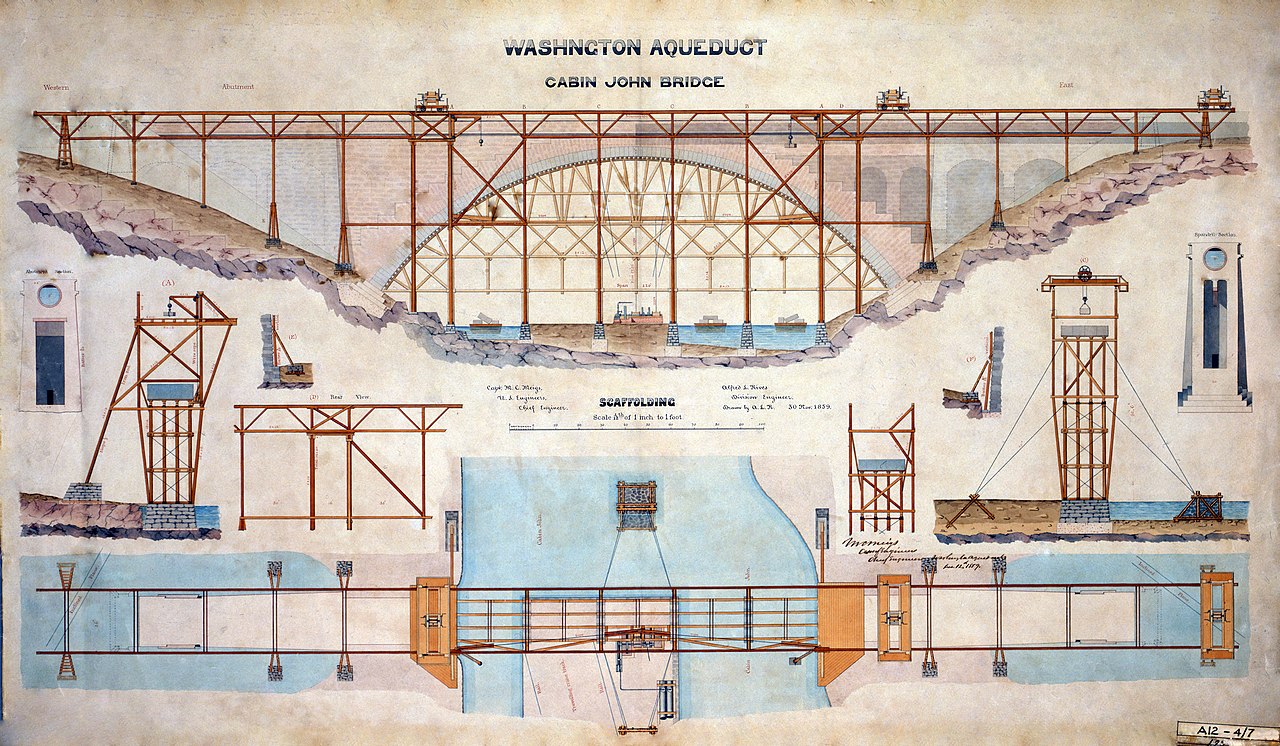
English: Watercolor Rendering of Cabin John Bridge Scaffolding, Washington Aqueduct. Captain M.C. Meigs, Chief Engineer; Alfred L. Rives, Assistant Engineer, Delineator. (Also called Union Arch Bridge. Location: Cabin John, Maryland.) Archived by U.S. National Park Service, Historic American Engineering Record. |
|||||||
| Date | ||||||||
| Source |
|
|||||||
| Author | U.S. Army Corps of Engineers. Alfred L. Rives, Assistant Engineer, Delineator. | |||||||
| Permission (Reusing this file) |
|

| Camera location | | View this and other nearby images on: OpenStreetMap |
|---|
File history
Click on a date/time to view the file as it appeared at that time.
| Date/Time | Thumbnail | Dimensions | User | Comment | |
|---|---|---|---|---|---|
| current | 04:05, 13 June 2008 | | 4,442 × 2,589 (2.24 MB) | Moreau1 | {{Information |Description={{en|1=Watercolor Rendering of Cabin John Bridge Scaffolding, Washington Aqueduct. Captain M.C. Meigs, Chief Engineer; Alfred L. Rives, Assistant Engineer, Delineator. (Also called Wikipedia:Union Arch Bridge. Location: Cabi |
File usage
The following pages on the English Wikipedia use this file (pages on other projects are not listed):
Global file usage
The following other wikis use this file:
- Usage on ca.wikipedia.org
- Usage on de.wikipedia.org
- Usage on es.wikipedia.org
- Usage on fr.wikipedia.org
- Usage on vi.wikipedia.org
- Usage on www.wikidata.org