
File:Claravalls - Castell.jpg

Original file (2,616 × 3,488 pixels, file size: 2.17 MB, MIME type: image/jpeg)
| This is a file from the Wikimedia Commons. Information from its description page there is shown below. Commons is a freely licensed media file repository. You can help. |
| Description |
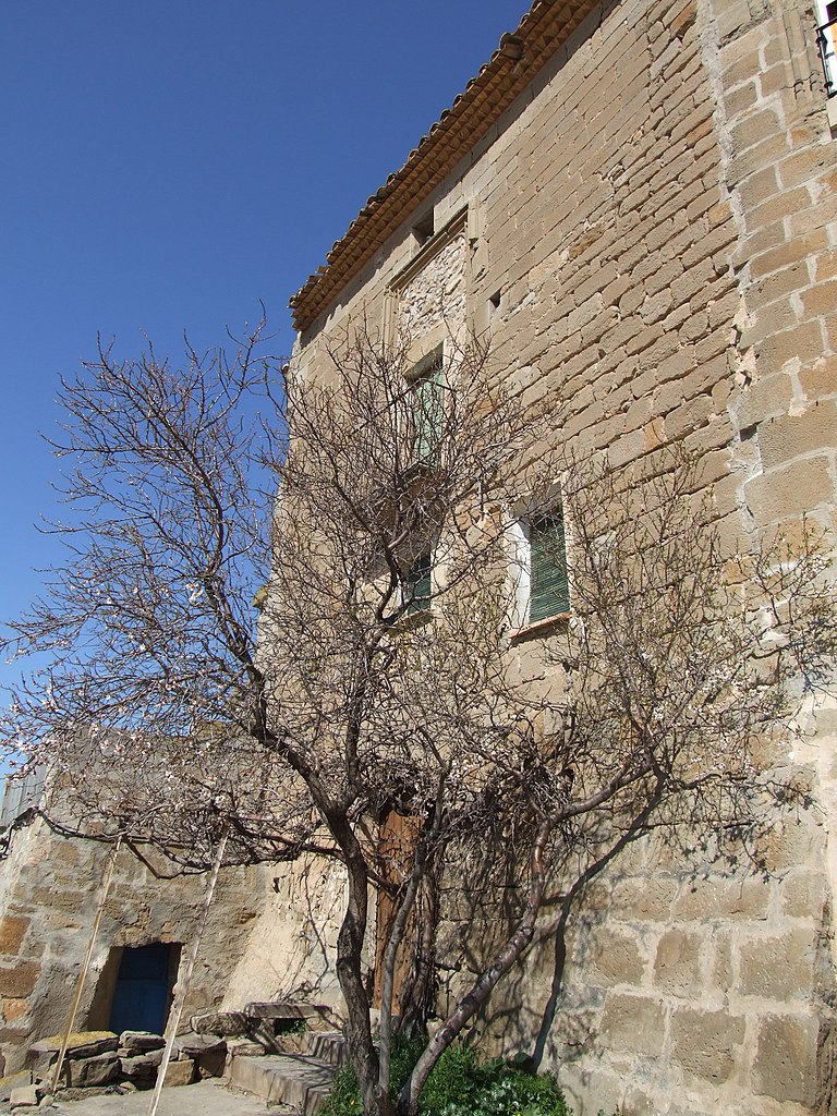
Documentat el 1116 a través d'un testament en el qual Pere Ponç llega a la seva esposa Sança el castell. El 1172 un altre testament aixecat per Bernat de Fluvià el deixa al seu germà Guillem Claravalls. Formava part de l'extrem occidental de la marca de Berga. Està situat dalt d’un turó i presideix la població. L’estructura és de planta rectangular i té planta baixa i tres pisos. El primitiu castell data del s.XI però la construcció actual pertany al segle XVI i al llarg dels anys ha sofert diferents transformacions. Actualment és de propietat particular. L’any 1985 fou declarat Bé Cultural d’Interès Nacional.
|
||
| Date | |||
| Source | Flickr: Claravalls - Castell | ||
| Author | Ramon de cal Benido | ||
| Permission (Reusing this file) |
This file is licensed under the Creative Commons Attribution-Share Alike 2.0 Generic license.
|
| Object location | | View this and other nearby images on: OpenStreetMap |
|---|

|
This image was uploaded as part of Wiki Loves Monuments 2011.
|
|
File history
Click on a date/time to view the file as it appeared at that time.
| Date/Time | Thumbnail | Dimensions | User | Comment | |
|---|---|---|---|---|---|
| current | 21:42, 6 September 2011 | | 2,616 × 3,488 (2.17 MB) | Flickr upload bot | Uploaded from http://flickr.com/photo/29105160@N06/3751730442 using Flickr upload bot |
File usage
Global file usage
The following other wikis use this file:
- Usage on ca.wikipedia.org
- Usage on es.wikipedia.org
- Usage on vi.wikipedia.org
- Usage on www.wikidata.org