
File:Dry Rigg Quarry - geograph.org.uk - 1502618.jpg
Size of this preview: 450 × 600 pixels. Other resolutions: 180 × 240 pixels | 480 × 640 pixels.
Original file (480 × 640 pixels, file size: 93 KB, MIME type: image/jpeg)
| This is a file from the Wikimedia Commons. Information from its description page there is shown below. Commons is a freely licensed media file repository. You can help. |
Summary
| Description |
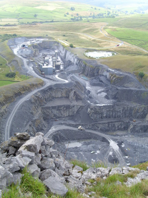
English: Dry Rigg Quarry Looking down into the big hole from the edge of the limestone. The huge quarry truck looks to be the size of a 'Matchbox' toy. Both Dry Rigg and Arcow Quarries are due to close in the next year or two, and much of the landscape will be restored. This is an opportunity to create new habitats, restore old ones, and maybe create a fascinating geology trail, but on the other hand a number of jobs will be lost. |
| Date | |
| Source | From geograph.org.uk |
| Author | Gordon Hatton |
| Attribution (required by the license) | Gordon Hatton / Dry Rigg Quarry / |
| Camera location | | View this and other nearby images on: OpenStreetMap |
|---|
_heading:135.00&language=en)
| Object location | | View this and other nearby images on: OpenStreetMap |
|---|
_heading:135.00&language=en)
Licensing

|
This image was taken from the Geograph project collection. See this photograph's page on the Geograph website for the photographer's contact details. The copyright on this image is owned by Gordon Hatton and is licensed for reuse under the Creative Commons Attribution-ShareAlike 2.0 license.
|
This file is licensed under the Creative Commons Attribution-Share Alike 2.0 Generic license.
Attribution: Gordon Hatton
- You are free:
- to share – to copy, distribute and transmit the work
- to remix – to adapt the work
- Under the following conditions:
- attribution – You must give appropriate credit, provide a link to the license, and indicate if changes were made. You may do so in any reasonable manner, but not in any way that suggests the licensor endorses you or your use.
- share alike – If you remix, transform, or build upon the material, you must distribute your contributions under the same or compatible license as the original.

|
The categories of this image need checking. You can do so here.
|
File history
Click on a date/time to view the file as it appeared at that time.
| Date/Time | Thumbnail | Dimensions | User | Comment | |
|---|---|---|---|---|---|
| current | 20:27, 2 March 2011 | | 480 × 640 (93 KB) | GeographBot | == {{int:filedesc}} == {{Information |description={{en|1=Dry Rigg Quarry Looking down into the big hole from the edge of the limestone. The huge quarry truck looks to be the size of a 'Matchbox' toy. Both Dry Rigg and Arcow Quarries are due to close in th |
File usage
The following pages on the English Wikipedia use this file (pages on other projects are not listed):