
File:Exterior grounds and plaza by Snøhetta at the Blanton Museum of Art in Austin--photo by Steven Saylor.jpg
Size of this preview: 800 × 442 pixels. Other resolutions: 320 × 177 pixels | 640 × 353 pixels | 1,024 × 565 pixels | 1,280 × 707 pixels | 2,560 × 1,413 pixels | 4,032 × 2,226 pixels.
Original file (4,032 × 2,226 pixels, file size: 1 MB, MIME type: image/jpeg)
| This is a file from the Wikimedia Commons. Information from its description page there is shown below. Commons is a freely licensed media file repository. You can help. |
Summary
| Description |
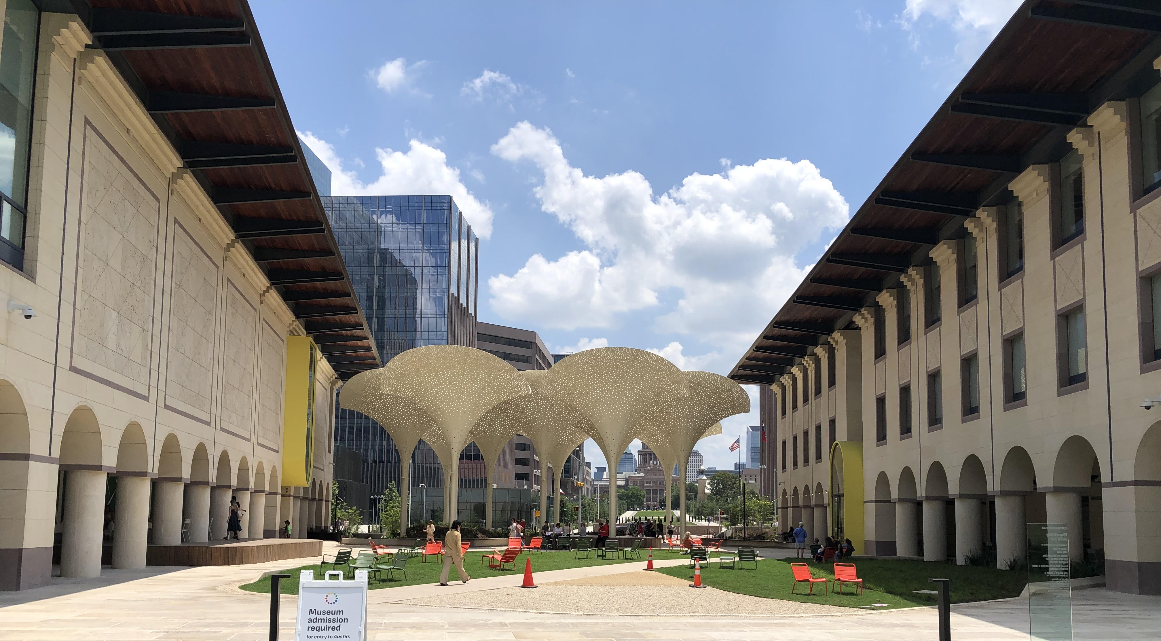
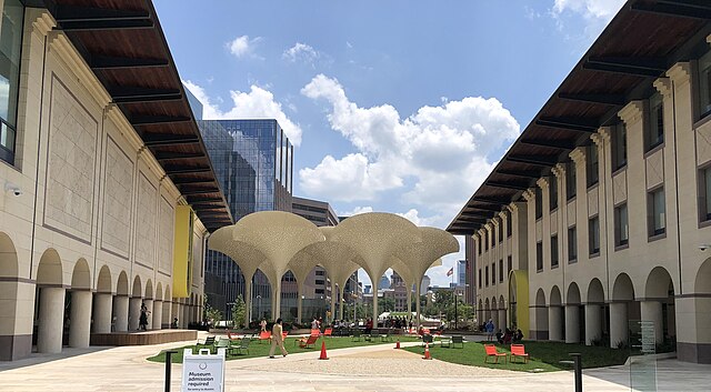
English: Exterior grounds and plaza designed by Snøhetta at the Blanton Museum of Art in Austin, Texas. Features include twelve towering, three-stories-tall "petals" which provide perforated shade. In the distance is the Texas State Capitol building; at right, the Edgar A. Smith Building (education, administration, cafe, gift shop, and admissions desk); at left, the Mari and James A. Michener Gallery Building. Photo by Steven Saylor |
| Date | |
| Source | Own work |
| Author | Stevensaylor |
| Camera location | | View this and other nearby images on: OpenStreetMap |
|---|
Licensing
I, the copyright holder of this work, hereby publish it under the following license:
This file is licensed under the Creative Commons Attribution-Share Alike 4.0 International license.
- You are free:
- to share – to copy, distribute and transmit the work
- to remix – to adapt the work
- Under the following conditions:
- attribution – You must give appropriate credit, provide a link to the license, and indicate if changes were made. You may do so in any reasonable manner, but not in any way that suggests the licensor endorses you or your use.
- share alike – If you remix, transform, or build upon the material, you must distribute your contributions under the same or compatible license as the original.
File history
Click on a date/time to view the file as it appeared at that time.
| Date/Time | Thumbnail | Dimensions | User | Comment | |
|---|---|---|---|---|---|
| current | 17:53, 24 April 2024 | | 4,032 × 2,226 (1 MB) | Stevensaylor | Uploaded own work with UploadWizard |
File usage
The following pages on the English Wikipedia use this file (pages on other projects are not listed):