
File:Flattery Rocks NWR Map.svg

Size of this PNG preview of this SVG file: 523 × 599 pixels. Other resolutions: 209 × 240 pixels | 419 × 480 pixels | 670 × 768 pixels | 894 × 1,024 pixels | 1,788 × 2,048 pixels | 550 × 630 pixels.
Original file (SVG file, nominally 550 × 630 pixels, file size: 591 KB)
| This is a file from the Wikimedia Commons. Information from its description page there is shown below. Commons is a freely licensed media file repository. You can help. |
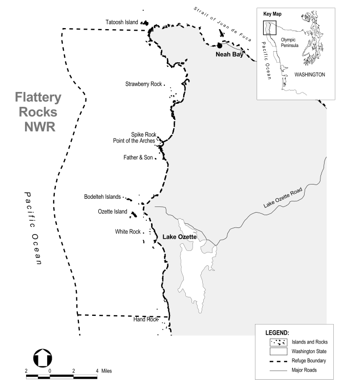
| Description | Map of the Flattery Rocks National Wildlife Refuge, off the coast of Washington state. | |||
| Source |
Extracted from PDF version of Washington Islands National Wildlife Refuges Final Comprehensive Conservation Plan and Environmental Assessment for the Flattery Rocks, Copalis, and Quillayute Needles National Wildlife Refuges (direct PDF URL [1]; 25MB), page 1-5. |
|||
| Author | U.S. Government | |||
| Permission (Reusing this file) |
|

File history
Click on a date/time to view the file as it appeared at that time.
| Date/Time | Thumbnail | Dimensions | User | Comment | |
|---|---|---|---|---|---|
| current | 11:54, 17 May 2010 | | 550 × 630 (591 KB) | Clindberg | {{Information |Description=Map of the w:Flattery Rocks National Wildlife Refuge, off the coast of Washington state. |Source=Extracted from PDF version of [http://library.fws.gov/RefugePlanningDocumentsAlphabetical.html Washington Islands National Wil |
File usage
The following pages on the English Wikipedia use this file (pages on other projects are not listed):
Global file usage
The following other wikis use this file:
- Usage on ceb.wikipedia.org
- Usage on cs.wikipedia.org
- Usage on www.wikidata.org