
File:Former railway line, Gifford (2) (geograph 3280532).jpg
No higher resolution available.
Former_railway_line,_Gifford_(2)_(geograph_3280532).jpg (800 × 530 pixels, file size: 185 KB, MIME type: image/jpeg)
| This is a file from the Wikimedia Commons. Information from its description page there is shown below. Commons is a freely licensed media file repository. You can help. |
_(geograph_3280532).jpg)
Summary
| Description |
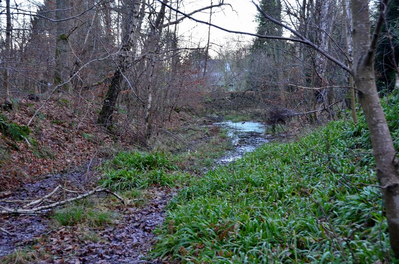
English: Former railway line, Gifford (2) The route of the Gifford & Garvald Light Railway, a branch line from Ormiston. It did not reach Garvald, but ended in two short branches SE of Fawn Wood, beyond Gifford Station. A nearby cottage is named 'Station House'. The line can be seen on the 1903 One Inch OS sheet 33. A view towards the site of the former station, with some of the trackbed now waterlogged. |
| Date | |
| Source | From geograph.org.uk |
| Author | Jim Barton |
| Permission (Reusing this file) |
Creative Commons Attribution Share-alike license 2.0 |
| Attribution (required by the license) | Jim Barton / Former railway line, Gifford (2) / |
| Camera location | | View this and other nearby images on: OpenStreetMap |
|---|
_(geograph_3280532).jpg¶ms=055.905042_N_-002.755071_E_globe:Earth_type:camera_source:geograph-osgb36(NT52896825)_heading:22.00&language=en)
| Object location | | View this and other nearby images on: OpenStreetMap |
|---|
_(geograph_3280532).jpg¶ms=055.905310_N_-002.754920_E_globe:Earth_class:object_type:object_source:geograph-osgb36(NT52906828)_heading:22.00&language=en)
Licensing

|
This image was taken from the Geograph project collection. See this photograph's page on the Geograph website for the photographer's contact details. The copyright on this image is owned by Jim Barton and is licensed for reuse under the Creative Commons Attribution-ShareAlike 2.0 license.
|
This file is licensed under the Creative Commons Attribution-Share Alike 2.0 Generic license.
Attribution: Jim Barton
- You are free:
- to share – to copy, distribute and transmit the work
- to remix – to adapt the work
- Under the following conditions:
- attribution – You must give appropriate credit, provide a link to the license, and indicate if changes were made. You may do so in any reasonable manner, but not in any way that suggests the licensor endorses you or your use.
- share alike – If you remix, transform, or build upon the material, you must distribute your contributions under the same or compatible license as the original.
File history
Click on a date/time to view the file as it appeared at that time.
| Date/Time | Thumbnail | Dimensions | User | Comment | |
|---|---|---|---|---|---|
| current | 21:32, 11 December 2020 | | 800 × 530 (185 KB) | Lamberhurst | Transferred from geograph.co.uk using [https://tools.wmflabs.org/geograph2commons/ geograph2commons] |
File usage
The following pages on the English Wikipedia use this file (pages on other projects are not listed):
Global file usage
The following other wikis use this file:
- Usage on www.wikidata.org
_(geograph_3280532).jpg)