
File:Governors Island National Monument, New York LOC 2009575006.jpg

Size of this preview: 659 × 600 pixels. Other resolutions: 264 × 240 pixels | 527 × 480 pixels | 844 × 768 pixels | 1,125 × 1,024 pixels | 2,250 × 2,048 pixels | 5,319 × 4,841 pixels.
Original file (5,319 × 4,841 pixels, file size: 4.31 MB, MIME type: image/jpeg)
| This is a file from the Wikimedia Commons. Information from its description page there is shown below. Commons is a freely licensed media file repository. You can help. |
Summary
| Description |
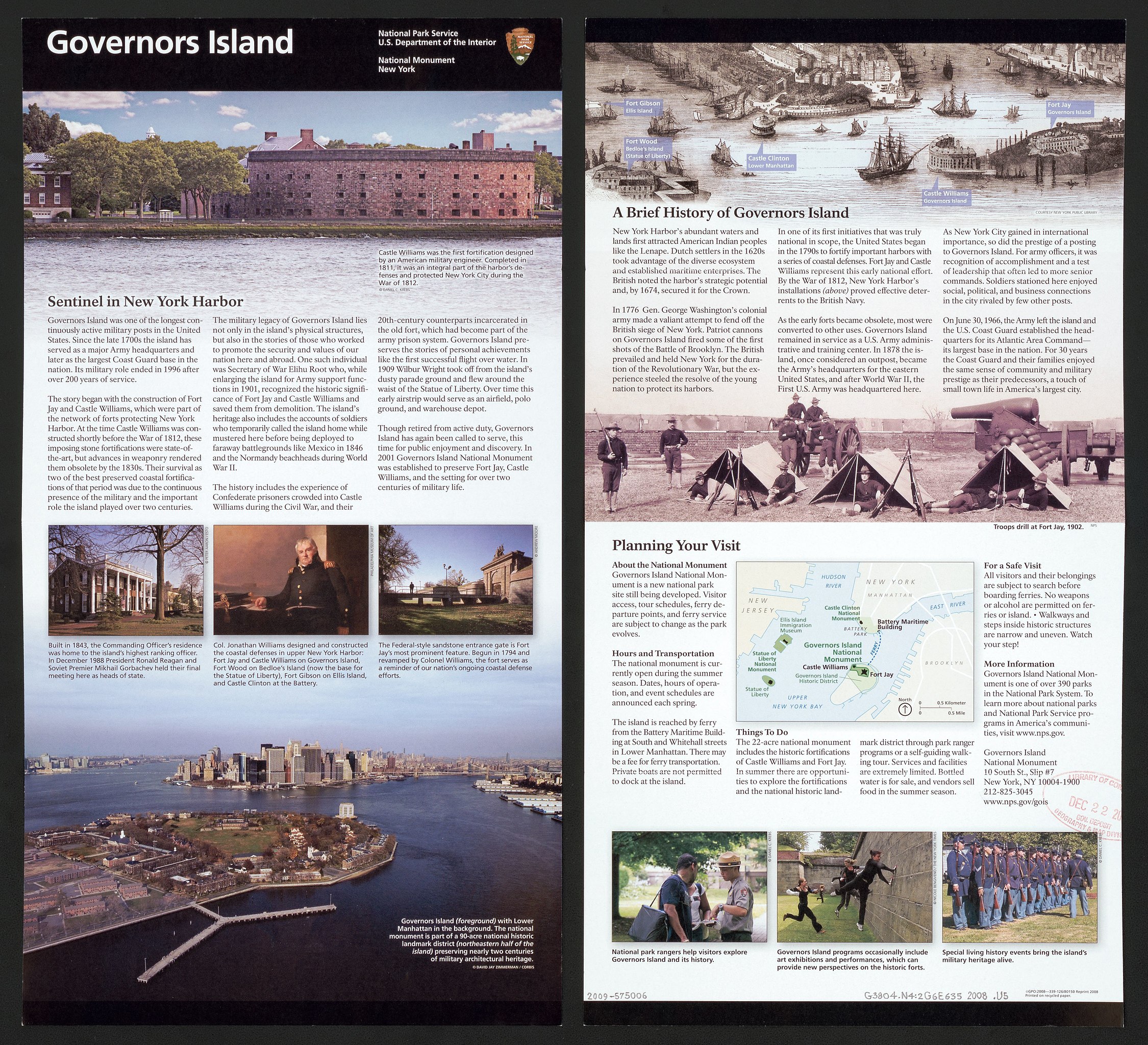
English: Island map is a regional location map showing showing the positions of other federally administered park properties in Upper New York Bay. "*GPO:2008--339-126/80150 Reprint 2008." Title from panel. Includes text and ill. (some col.). Available also through the Library of Congress Web site as a raster image. |
||
| Title | Governors Island National Monument, New York | ||
| Shelf ID | G3804.N4:2G6E635 2008 .U5 | ||
| Date | |||
| Source | https://www.loc.gov/item/2009575006/ | ||
| Author | United States. National Park Service | ||
| Permission (Reusing this file) |
|
||
| Other versions |
|
||
| Location | Governors Island · United States · New York · New York County · New York. · Governors Island Region · New York (State) | ||
| Part of | American Memory · General Maps · Catalog · Geography And Map Division | ||
| Subject | Aerial Views · Historic Sites · Governors Island (New York County, N.Y.) · Governors Island · Tourist Maps · United States · Maps · New York · Governors Island Region (New York County, N.Y.) · Governors Island Region · New York County · National Parks And Reserves · New York (State) |


Licensing
| This image or media file contains material based on a work of a National Park Service employee, created as part of that person's official duties. As a work of the U.S. federal government, such work is in the public domain in the United States. See the NPS website and NPS copyright policy for more information. |
File history
Click on a date/time to view the file as it appeared at that time.
| Date/Time | Thumbnail | Dimensions | User | Comment | |
|---|---|---|---|---|---|
| current | 07:54, 3 August 2018 | | 5,319 × 4,841 (4.31 MB) | Fæ | LOC Maps https://www.loc.gov/item/2009575006/ #20559 |
File usage
The following pages on the English Wikipedia use this file (pages on other projects are not listed):
Global file usage
The following other wikis use this file:
- Usage on ja.wikipedia.org