
File:Kent Long Distance Footpaths.png

Size of this preview: 800 × 525 pixels. Other resolutions: 320 × 210 pixels | 640 × 420 pixels | 1,024 × 672 pixels | 1,280 × 840 pixels.
Original file (1,280 × 840 pixels, file size: 845 KB, MIME type: image/png)
| This is a file from the Wikimedia Commons. Information from its description page there is shown below. Commons is a freely licensed media file repository. You can help. |
| Description |
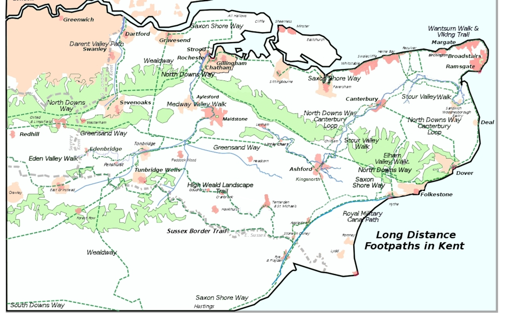
English: Adapted from User:ClemRutter who in 2007 produced a less detailed map of all the long distance footpaths in Kent in 2007 this 2012 has the Sussex Border Path and omits the London Circular and Vanguard paths for only a tiny % being in the Kent. Inspired by Jessop, Kent History Illustrated, with details from the KCC Public transport Map 2006/2007. There will be inaccuracies where paths join, or run parallel to a feature that was symbolic on the base map. Please inform me of serious errors and omissions via my Talk page. Constructed using Inkscape 0.45.1, so there may be rendering problems. Version 1 chose yellow for the path, it was great on the screen, but bad on the printer. I had used yellow because it follows the Yellow Arrow on the Waymarkers. This version uses dark green and changes the font so it is easier to read when rendered into a png. The Rivers are now blue. The spelling mistake in the name has been corrected. |
| Date | |
| Source | Wikimedia Commons |
| Author | Clem Rutter |
| Permission (Reusing this file) |
see  |
- Other information
English: No

|
Permission is granted to copy, distribute and/or modify this document under the terms of the GNU Free Documentation License, Version 1.2 or any later version published by the Free Software Foundation; with no Invariant Sections, no Front-Cover Texts, and no Back-Cover Texts. A copy of the license is included in the section entitled GNU Free Documentation License. |
If this file is eligible for relicensing, it may also be used under the Creative Commons Attribution-ShareAlike 3.0 license. The relicensing status of this image needs to be manually reviewed by an experienced user. You can help.
|
File history
Click on a date/time to view the file as it appeared at that time.
| Date/Time | Thumbnail | Dimensions | User | Comment | |
|---|---|---|---|---|---|
| current | 21:05, 24 May 2012 | | 1,280 × 840 (845 KB) | Adam37 | {{subst:Upload marker added by en.wp UW}} {{Information |Description = {{en|Adapted from User:ClemRutter who in 2007 produced a less detailed map of all the long distance footpaths in Kent in 2007 this 2012 has the Sussex Border... |
File usage
The following pages on the English Wikipedia use this file (pages on other projects are not listed):
Global file usage
The following other wikis use this file:
- Usage on de.wikipedia.org