
File:Kingdom of Kombo Map.png
Size of this preview: 800 × 575 pixels. Other resolutions: 320 × 230 pixels | 640 × 460 pixels | 1,024 × 736 pixels | 1,280 × 920 pixels | 1,770 × 1,272 pixels.
Original file (1,770 × 1,272 pixels, file size: 41 KB, MIME type: image/png)
| This is a file from the Wikimedia Commons. Information from its description page there is shown below. Commons is a freely licensed media file repository. You can help. |
Summary
| Description |
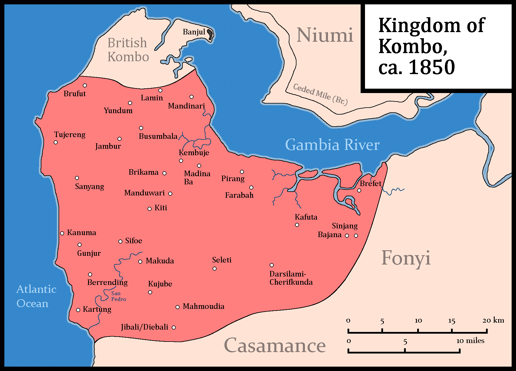
English: Own work.
Source for the Ceded Mile: Hughes, A., & Perfect, D. (2008). Historical Dictionary of The Gambia. Scarecrow Press. P.XVIII & 33. Source for cities, coastline, rivers and names: Skinner, D. E. (2012). Islam in Kombo: The Spiritual and Militant Jihād of Fodé Ibrahim Silla Turé. Islamic Africa, 3(1), 87–126. http://www.jstor.org/stable/42636192 P.92. Source for the borders of Kombo: Quinn, C. A. (1972). Mandingo kingdoms of the Senegambia; traditionalism, Islam and European expansion. Longman. P.VIII-IX. |
| Date | |
| Source | Own work |
| Author | HetmanTheResearcher |
Licensing
I, the copyright holder of this work, hereby publish it under the following license:
This file is licensed under the Creative Commons Attribution 4.0 International license.
- You are free:
- to share – to copy, distribute and transmit the work
- to remix – to adapt the work
- Under the following conditions:
- attribution – You must give appropriate credit, provide a link to the license, and indicate if changes were made. You may do so in any reasonable manner, but not in any way that suggests the licensor endorses you or your use.
File history
Click on a date/time to view the file as it appeared at that time.
| Date/Time | Thumbnail | Dimensions | User | Comment | |
|---|---|---|---|---|---|
| current | 01:59, 11 January 2024 | | 1,770 × 1,272 (41 KB) | HetmanTheResearcher | Uploaded own work with UploadWizard |
File usage
The following pages on the English Wikipedia use this file (pages on other projects are not listed):