
File:Kramerspitz.jpg

Size of this preview: 800 × 532 pixels. Other resolutions: 320 × 213 pixels | 640 × 426 pixels | 1,024 × 681 pixels | 1,155 × 768 pixels.
Original file (1,155 × 768 pixels, file size: 534 KB, MIME type: image/jpeg)
| This is a file from the Wikimedia Commons. Information from its description page there is shown below. Commons is a freely licensed media file repository. You can help. |
Summary
| Description |
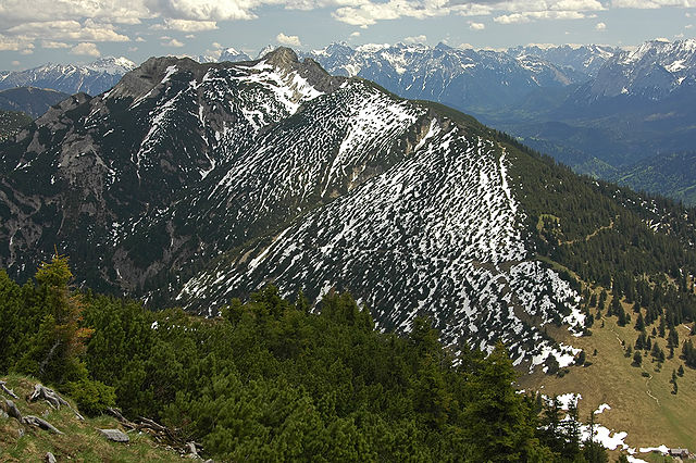
Deutsch: Kramerspitz (Ammergauer Alpen).
Das Gipfelkreuz ist - auf dem Bild schwer erkennbar - auf dem höchsten Punkt des Berges im Vordergrund. Eine Drehung des Beobachters nach rechts würde Eibsee und Zugspitze erkennen lassen. Die Hütte rechts unten im Bild ist die Stepbergalm. |
| Date | |
| Source | photo taken by Kogo |
| Author | Kogo |
| Permission (Reusing this file) |
Kogo put it under the GFDL |
| Camera location | | View this and other nearby images on: OpenStreetMap |
|---|

|
Permission is granted to copy, distribute and/or modify this document under the terms of the GNU Free Documentation License, Version 1.2 or any later version published by the Free Software Foundation; with no Invariant Sections, no Front-Cover Texts, and no Back-Cover Texts. A copy of the license is included in the section entitled GNU Free Documentation License. |
File history
Click on a date/time to view the file as it appeared at that time.
| Date/Time | Thumbnail | Dimensions | User | Comment | |
|---|---|---|---|---|---|
| current | 12:00, 27 May 2005 | | 1,155 × 768 (534 KB) | Kogo | Kramerspitz |
File usage
The following pages on the English Wikipedia use this file (pages on other projects are not listed):
Global file usage
The following other wikis use this file:
- Usage on arz.wikipedia.org
- Usage on ceb.wikipedia.org
- Usage on de.wikipedia.org
- Usage on fi.wikipedia.org
- Usage on fr.wikipedia.org
- Usage on lld.wikipedia.org
- Usage on pl.wikipedia.org
- Usage on www.wikidata.org
- Usage on zh.wikipedia.org