
File:Lighthouse DSC00553 - Queen's Wharf Lighthouse (7603898804).jpg
Original file (6,000 × 4,000 pixels, file size: 23.17 MB, MIME type: image/jpeg)
| This is a file from the Wikimedia Commons. Information from its description page there is shown below. Commons is a freely licensed media file repository. You can help. |
.jpg)
Summary
| Description |
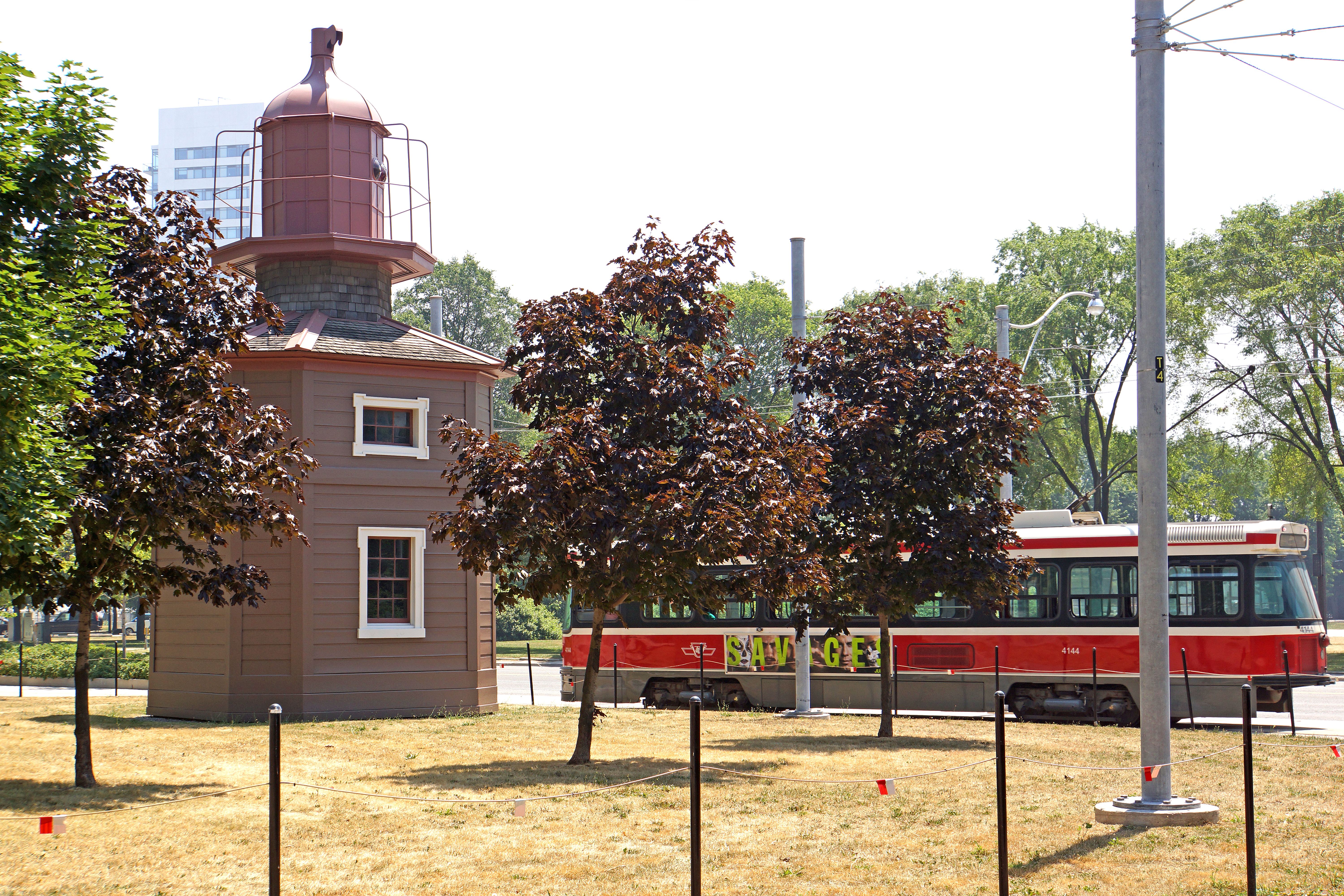
PLEASE, no multi invitations, glitters or self promotion in your comments, THEY WILL BE DELETED. My photos are FREE for anyone to use, just give me credit and it would be nice if you let me know, thanks - NONE OF MY PICTURES ARE HDR. The Queen's Wharf Lighthouse (also known as the Fleet Street Lighthouse, after its current location) is located at Fleet Street just east of the Princes' Gates at the Exhibition Place Grounds in Toronto. The octagonal building was originally part of a pair of lighthouses built in 1861 at Queen's Wharf, replacing an earlier lighthouse originally built in 1838. The 11m (36ft) three-storey wood structure is one of two major lighthouses in Toronto harbour. The building is a bare frame structure, and was never meant to be used as a dwelling by a lighthouse keeper. It currently sits at the edge of a small park about one block north from the current shoreline, and is contained within a small Toronto Transit Commission streetcar loop. |
| Date | |
| Source | DSC00553 - Queen's Wharf Lighthouse |
| Author | Dennis Jarvis from Halifax, Canada |
| Camera location | | View this and other nearby images on: OpenStreetMap |
|---|
.jpg¶ms=043.635811_N_-079.404394_E_globe:Earth_type:camera_source:Flickr_&language=en)
Licensing
- You are free:
- to share – to copy, distribute and transmit the work
- to remix – to adapt the work
- Under the following conditions:
- attribution – You must give appropriate credit, provide a link to the license, and indicate if changes were made. You may do so in any reasonable manner, but not in any way that suggests the licensor endorses you or your use.
- share alike – If you remix, transform, or build upon the material, you must distribute your contributions under the same or compatible license as the original.
| This image was originally posted to Flickr by archer10 (Dennis) (62M Views) at https://flickr.com/photos/22490717@N02/7603898804. It was reviewed on 24 December 2015 by FlickreviewR and was confirmed to be licensed under the terms of the cc-by-sa-2.0. |
File history
Click on a date/time to view the file as it appeared at that time.
| Date/Time | Thumbnail | Dimensions | User | Comment | |
|---|---|---|---|---|---|
| current | 16:20, 24 December 2015 | | 6,000 × 4,000 (23.17 MB) | JvA43 | Transferred from Flickr via Flickr2Commons |
.jpg)