
File:Location of Fort Itapiru.png

Size of this preview: 467 × 600 pixels. Other resolutions: 187 × 240 pixels | 374 × 480 pixels | 598 × 768 pixels | 797 × 1,024 pixels | 1,594 × 2,048 pixels | 3,470 × 4,457 pixels.
Original file (3,470 × 4,457 pixels, file size: 9.91 MB, MIME type: image/png)
| This is a file from the Wikimedia Commons. Information from its description page there is shown below. Commons is a freely licensed media file repository. You can help. |
Summary
| Description |
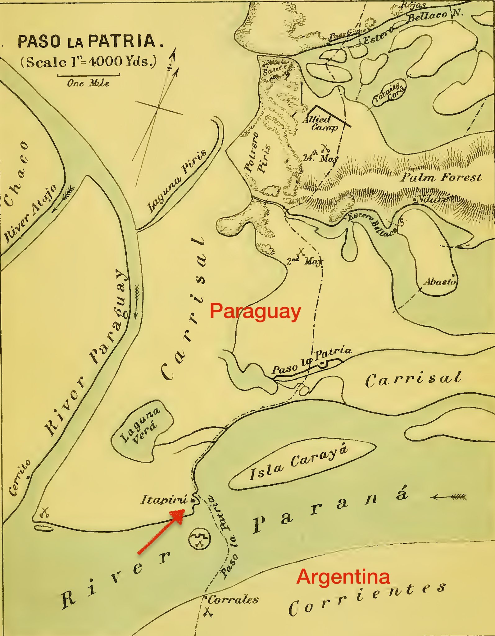
English: Map (George Thompson, "The War in Paraguay", 1869) showing the location of Fort Itapirú, which guarded the entrance to the channel behind Carayá island. Most of the Paraguayan coastline was too swampy to invade, but an exception occurred at Paso de Patria where there was a firm beach where a landing could be made.
Español: Ubicación de la fortaleza de Itapirú en el Alto Paraná |
| Date | |
| Source | Internet Archive |
| Author | George Thompson |
Licensing
|
This work is in the public domain in its country of origin and other countries and areas where the copyright term is the author's life plus 70 years or fewer. This work is in the public domain in the United States because it was published (or registered with the U.S. Copyright Office) before January 1, 1929. | |
| This file has been identified as being free of known restrictions under copyright law, including all related and neighboring rights. | |
File history
Click on a date/time to view the file as it appeared at that time.
| Date/Time | Thumbnail | Dimensions | User | Comment | |
|---|---|---|---|---|---|
| current | 23:36, 2 January 2020 | | 3,470 × 4,457 (9.91 MB) | Ttocserp | User created page with UploadWizard |
File usage
The following pages on the English Wikipedia use this file (pages on other projects are not listed):