
File:MapWithLegendShowingTownlandsInGlenkeenCivilParish.jpg

Size of this preview: 800 × 466 pixels. Other resolutions: 320 × 186 pixels | 640 × 372 pixels | 1,024 × 596 pixels | 1,280 × 745 pixels | 2,560 × 1,490 pixels | 4,000 × 2,328 pixels.
Original file (4,000 × 2,328 pixels, file size: 1.89 MB, MIME type: image/jpeg)
| This is a file from the Wikimedia Commons. Information from its description page there is shown below. Commons is a freely licensed media file repository. You can help. |
Summary
| Description |
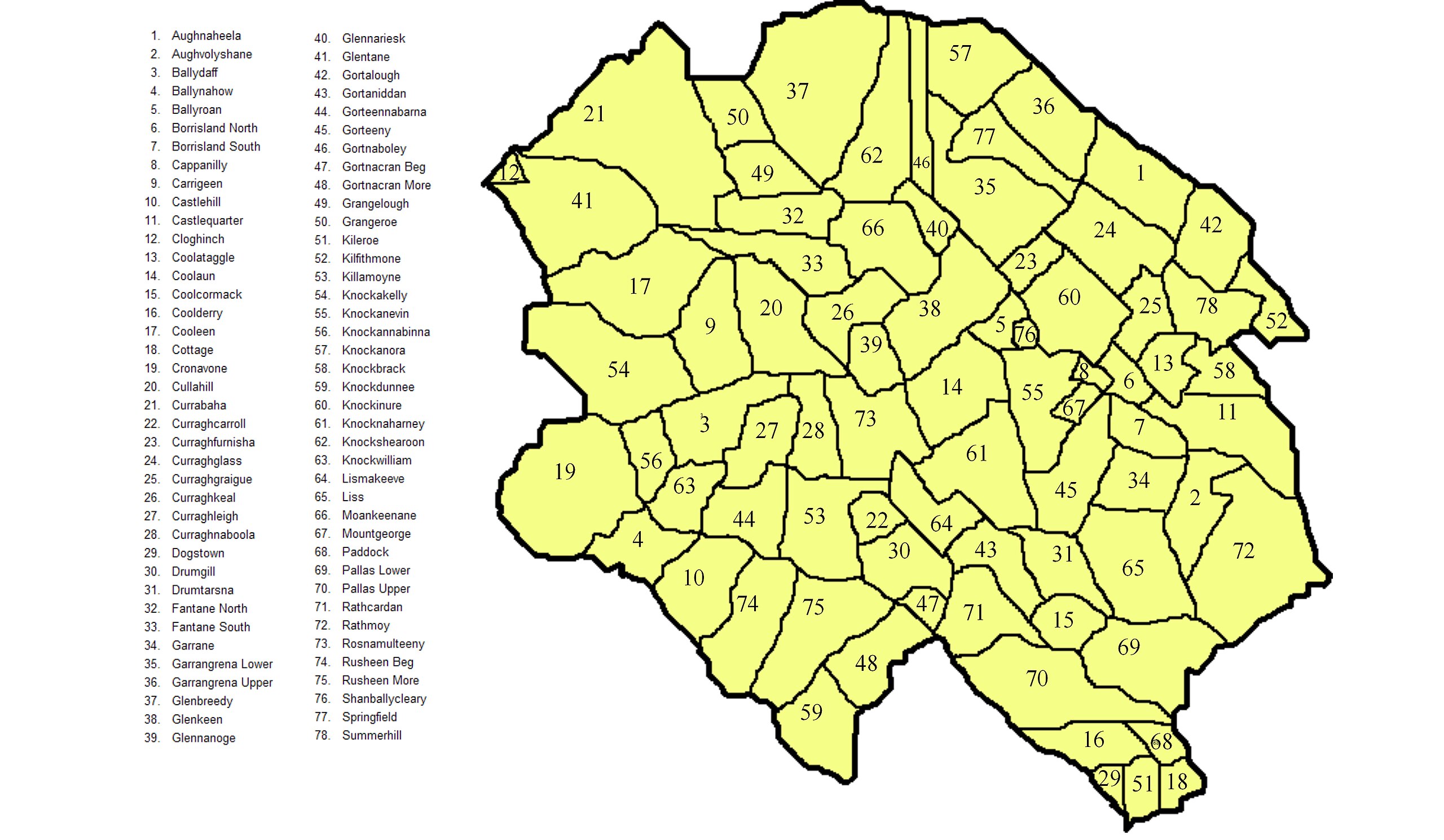
English: Map with legend showing townlands in Glenkeen civil parish in North Tipperary. A version of this map, without the legend and showing just the boundaries is available here. Since this civil parish is co-extensive with the Roman Catholic parish of Borrisoleigh and Ileigh, these townland boundaries also refer to the latter. This map is based on this sketch map, which seems to agree with this map. |
| Date | |
| Source | Own work |
| Author | MartinCollin |
Licensing
I, the copyright holder of this work, hereby publish it under the following license:
This file is licensed under the Creative Commons Attribution-Share Alike 3.0 Unported license.
- You are free:
- to share – to copy, distribute and transmit the work
- to remix – to adapt the work
- Under the following conditions:
- attribution – You must give appropriate credit, provide a link to the license, and indicate if changes were made. You may do so in any reasonable manner, but not in any way that suggests the licensor endorses you or your use.
- share alike – If you remix, transform, or build upon the material, you must distribute your contributions under the same or compatible license as the original.
File history
Click on a date/time to view the file as it appeared at that time.
| Date/Time | Thumbnail | Dimensions | User | Comment | |
|---|---|---|---|---|---|
| current | 16:41, 21 September 2012 | | 4,000 × 2,328 (1.89 MB) | MartinCollin | User created page with UploadWizard |
File usage
The following pages on the English Wikipedia use this file (pages on other projects are not listed):