
File:Map of Japanese House of Representatives districts in Yamanashi Prefecture.svg

Original file (SVG file, nominally 503 × 521 pixels, file size: 15 KB)
| This is a file from the Wikimedia Commons. Information from its description page there is shown below. Commons is a freely licensed media file repository. You can help. |
Summary

|
This file may be updated to reflect new information. If you wish to use a specific version of the file without new updates being mirrored, please upload the required version as a separate file. |
| Description |
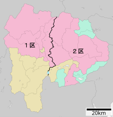
日本語: 衆議院議員小選挙区の山梨県における区割り。黒線=地方公共団体間の境界線上にある境界。 赤線=同一地方公共団体内にある境界。 水色線=海上または湖沼上での境界。 |
||
| Date | |||
| Source | File:包括自治体区画図 19000.svg(アップロード者はLincun)を元に作成。 | ||
| Author | 猿払の天馬 | ||
| Permission (Reusing this file) |
|
Licensing

|
Permission is granted to copy, distribute and/or modify this document under the terms of the GNU Free Documentation License, Version 1.2 or any later version published by the Free Software Foundation; with no Invariant Sections, no Front-Cover Texts, and no Back-Cover Texts. A copy of the license is included in the section entitled GNU Free Documentation License. |
- You are free:
- to share – to copy, distribute and transmit the work
- to remix – to adapt the work
- Under the following conditions:
- attribution – You must give appropriate credit, provide a link to the license, and indicate if changes were made. You may do so in any reasonable manner, but not in any way that suggests the licensor endorses you or your use.
- share alike – If you remix, transform, or build upon the material, you must distribute your contributions under the same or compatible license as the original.
Original upload log
- 2017-03-25 07:41 そらみみ 503×521× (14889 bytes) 線の太さを修正
- 2017-03-25 07:03 そらみみ 503×521× (14893 bytes) 細部修正
- 2017-03-25 07:02 そらみみ 503×521× (15106 bytes) 2017年3月25日 (土)05:31の版へ差し戻し (UTC)
- 2017-03-25 05:32 そらみみ 503×521× (22778 bytes) 2013年2月11日 (月)00:21の版へ差し戻し (UTC)
- 2017-03-25 05:31 そらみみ 503×521× (15106 bytes) 更新
- 2013-02-11 00:21 猿払の天馬 503×521× (22778 bytes) 2013年2月2日 (土)03:06の版へ差し戻し
- 2013-02-10 01:51 猿払の天馬 503×521× (26794 bytes) {{Information |Description=衆議院議員小選挙区の山梨県における区割り。黒線=地方公共団体間の境界線上にある境界。 赤線=同一地方公共団体内にある境界。 水色線=海上での境界。 |Source=[[:フ...
- 2013-02-10 01:45 猿払の天馬 503×521× (26932 bytes) {{Information |Description=衆議院議員小選挙区の山梨県における区割り。黒線=地方公共団体間の境界線上にある境界。 赤線=同一地方公共団体内にある境界。 水色線=海上での境界。 |Source=[[:フ...
- 2013-02-02 03:06 猿払の天馬 503×521× (22778 bytes) {{Information |Description=衆議院議員小選挙区の山梨県における区割り。黒線=地方公共団体間の境界線上にある境界。 赤線=同一地方公共団体内にある境界。 水色線=海上での境界。 |Source=[[:フ...
| This file was moved from Japanese Wikipedia.
See below for original file information. | ||||||||||||||||||||||||||||||||||||||||||||||||||||||||||||||||||||||||||||||||||||||||||||
| ||||||||||||||||||||||||||||||||||||||||||||||||||||||||||||||||||||||||||||||||||||||||||||
|
| ||||||||||||||||||||||||||||||||||||||||||||||||||||||||||||||||||||||||||||||||||||||||||||
File history
Click on a date/time to view the file as it appeared at that time.
| Date/Time | Thumbnail | Dimensions | User | Comment | |
|---|---|---|---|---|---|
| current | 19:47, 4 January 2023 | | 503 × 521 (15 KB) | そらみみ | 水色の線を追加 |
| 16:51, 4 January 2023 |  | 503 × 521 (15 KB) | そらみみ | 線の円滑化 | |
| 19:15, 3 October 2020 |  | 503 × 521 (15 KB) | OgreBot | (BOT): Reverting to most recent version before archival | |
| 19:15, 3 October 2020 |  | 503 × 521 (15 KB) | OgreBot | (BOT): Uploading old version of file from ja.wikipedia; originally uploaded on 2017-03-25 07:03:37 by そらみみ | |
| 19:15, 3 October 2020 |  | 503 × 521 (26 KB) | OgreBot | (BOT): Uploading old version of file from ja.wikipedia; originally uploaded on 2013-02-10 01:51:37 by 猿払の天馬 | |
| 19:15, 3 October 2020 |  | 503 × 521 (26 KB) | OgreBot | (BOT): Uploading old version of file from ja.wikipedia; originally uploaded on 2013-02-10 01:45:43 by 猿払の天馬 | |
| 19:14, 3 October 2020 |  | 503 × 521 (22 KB) | OgreBot | (BOT): Uploading old version of file from ja.wikipedia; originally uploaded on 2013-02-02 03:06:50 by 猿払の天馬 | |
| 03:38, 7 June 2017 |  | 503 × 521 (15 KB) | そらみみ | Update. | |
| 07:41, 25 March 2017 |  | 503 × 521 (15 KB) | そらみみ | 線の太さを修正 | |
| 07:03, 25 March 2017 |  | 503 × 521 (15 KB) | そらみみ | 細部修正 |
File usage
Global file usage
The following other wikis use this file:
- Usage on fr.wikipedia.org
- Usage on ja.wikipedia.org
- Usage on ko.wikipedia.org
- Usage on vi.wikipedia.org
- Usage on zh.wikipedia.org