
File:Map of Nork 1841 Lambert.png
Size of this preview: 578 × 600 pixels. Other resolutions: 231 × 240 pixels | 463 × 480 pixels | 740 × 768 pixels | 987 × 1,024 pixels | 1,530 × 1,587 pixels.
Original file (1,530 × 1,587 pixels, file size: 1.51 MB, MIME type: image/png)
| This is a file from the Wikimedia Commons. Information from its description page there is shown below. Commons is a freely licensed media file repository. You can help. |
Summary
| Description |
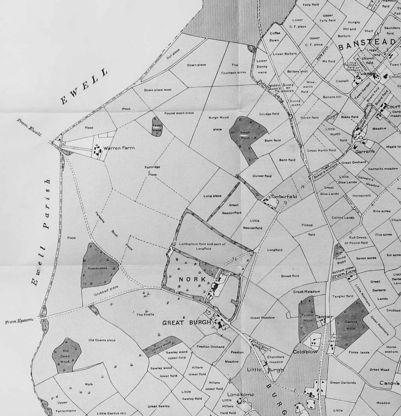
English: Part of a map in Lambert, H.C.M. 1912 History of Banstead in Surrey, based on a tithe map of 1841. This section shows much of what is present-day Nork. The map must be twisted 25° clockwise to point north. The width is 2.7 km. |
| Date | |
| Source | https://openlibrary.org/books/OL23304266M/History_of_Banstead_in_Surrey. |
| Author | H.C.M. Lambert |
Licensing
|
This work is in the public domain in its country of origin and other countries and areas where the copyright term is the author's life plus 70 years or fewer. This work is in the public domain in the United States because it was published (or registered with the U.S. Copyright Office) before January 1, 1929. | |
| This file has been identified as being free of known restrictions under copyright law, including all related and neighboring rights. | |
File history
Click on a date/time to view the file as it appeared at that time.
| Date/Time | Thumbnail | Dimensions | User | Comment | |
|---|---|---|---|---|---|
| current | 13:20, 7 March 2015 | | 1,530 × 1,587 (1.51 MB) | Jmchutchinson | User created page with UploadWizard |
File usage
The following pages on the English Wikipedia use this file (pages on other projects are not listed):