
File:Map of Syria (cropped).png
Size of this preview: 282 × 599 pixels. Other resolution: 300 × 637 pixels.
Original file (300 × 637 pixels, file size: 123 KB, MIME type: image/png)
| This is a file from the Wikimedia Commons. Information from its description page there is shown below. Commons is a freely licensed media file repository. You can help. |
Summary
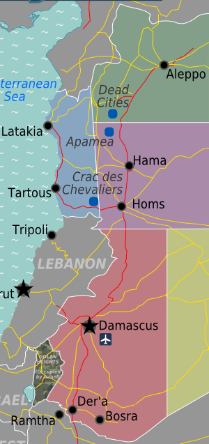
| Description | Map of Syria for use on Wikivoyage, English version |
| Date | (EDT) |
| Source | Own work based on the earlier map by NordNordWest |
| Author | cacahuate, amendments by Globe-trotter |
| Other versions |

.png)
.png)
Licensing
This file is licensed under the Creative Commons Attribution-Share Alike 3.0 Unported license.
- You are free:
- to share – to copy, distribute and transmit the work
- to remix – to adapt the work
- Under the following conditions:
- attribution – You must give appropriate credit, provide a link to the license, and indicate if changes were made. You may do so in any reasonable manner, but not in any way that suggests the licensor endorses you or your use.
- share alike – If you remix, transform, or build upon the material, you must distribute your contributions under the same or compatible license as the original.
Original upload log
| This file was imported from Wikivoyage WTS. |
The original description page was here. All following user names refer to wts.wikivoyage-old.
- 2009-06-02 05:15 (WT-shared) Cacahuate[dead link] 1000×781 (359485 bytes) {{Imagecredit |credit=~~~, [[:commons:User:NordNordWest|NordNordWest]] |captureDate=~~~~~ |location=Syria |source=[[:Image:Map of Syria.svg] (Import from wikitravel.org/shared)
- 2010-02-23 00:57 (WT-shared) Globe-trotter[dead link] 417×702 (166480 bytes) Changed regions, small changes to Golan Heights and the title (Import from wikitravel.org/shared)
- 2010-02-23 00:59 (WT-shared) Globe-trotter[dead link] 998×779 (335317 bytes) no idea what happened there. trying again. Changed regions, small changes to Golan Heights and the title (Import from wikitravel.org/shared)
File history
Click on a date/time to view the file as it appeared at that time.
| Date/Time | Thumbnail | Dimensions | User | Comment | |
|---|---|---|---|---|---|
| current | 16:28, 13 March 2020 | | 300 × 637 (123 KB) | Rwendland | File:Map of Syria.png cropped 70 % horizontally, 18 % vertically using CropTool with precise mode. |
File usage
The following pages on the English Wikipedia use this file (pages on other projects are not listed):
Global file usage
The following other wikis use this file:
- Usage on ar.wikipedia.org
.png)