
File:Maquette du Machault.jpg

Size of this preview: 800 × 533 pixels. Other resolutions: 320 × 213 pixels | 640 × 427 pixels | 1,024 × 683 pixels | 1,280 × 853 pixels | 2,560 × 1,707 pixels | 3,648 × 2,432 pixels.
Original file (3,648 × 2,432 pixels, file size: 3.61 MB, MIME type: image/jpeg)
| This is a file from the Wikimedia Commons. Information from its description page there is shown below. Commons is a freely licensed media file repository. You can help. |
Summary
| Camera location | | View this and other nearby images on: OpenStreetMap |
|---|
| Description |
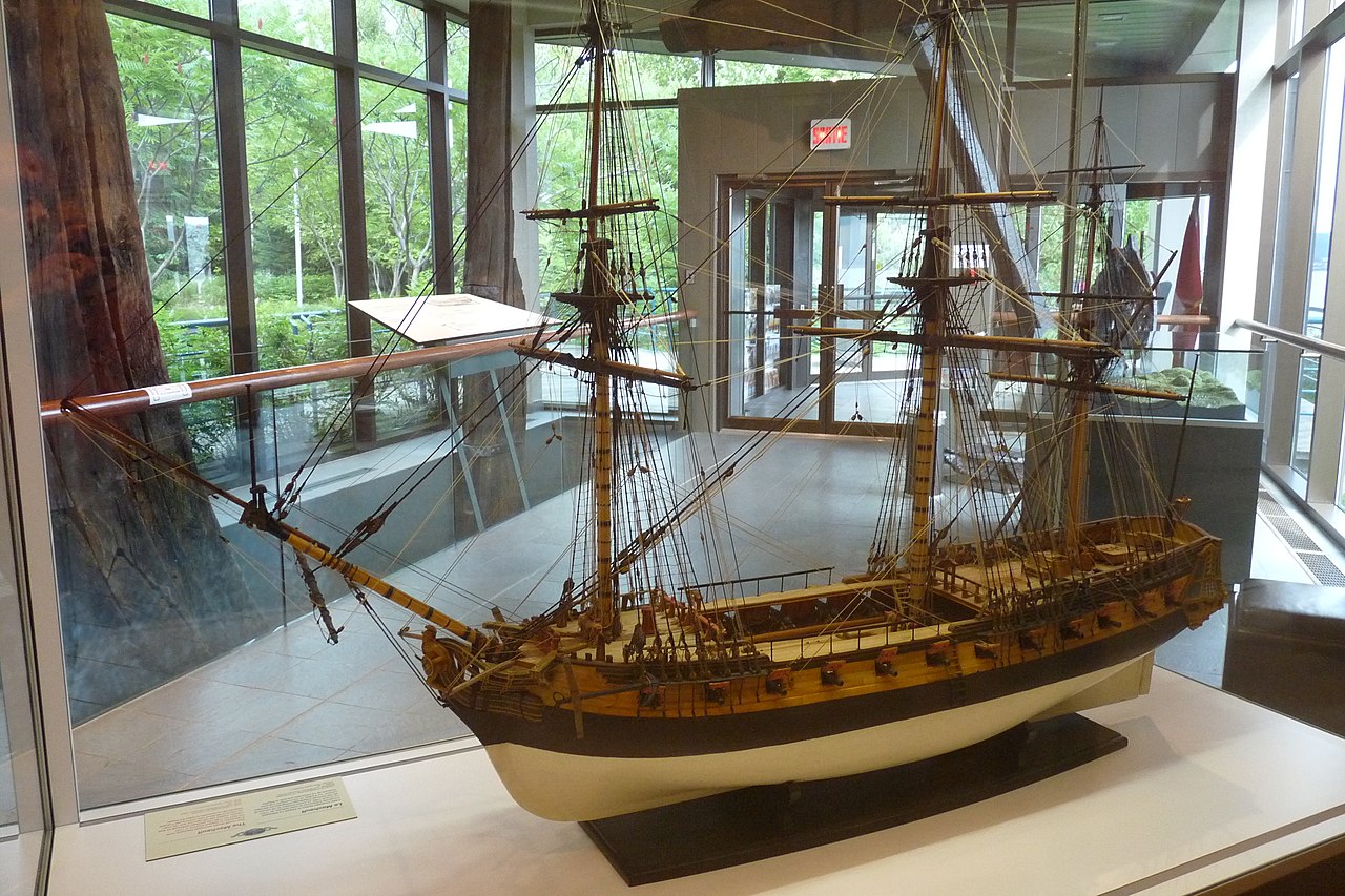
Français : Maquette de la frégate Le Machault dans le hall du centre d'interprétation de la Bataille de la Ristigouche
|
This photo is of a cultural heritage site in Canada, number 17341
|
|
| Date | |
| Source | Own work |
| Author | ChristianT |
La frégate le Machault a été coulée en 1760 lors de la dernière bataille navale entre la France et l'Angleterre pour le contrôle de la Nouvelle-France
Licensing
I, the copyright holder of this work, hereby publish it under the following license:
This file is licensed under the Creative Commons Attribution-Share Alike 3.0 Unported license.
- You are free:
- to share – to copy, distribute and transmit the work
- to remix – to adapt the work
- Under the following conditions:
- attribution – You must give appropriate credit, provide a link to the license, and indicate if changes were made. You may do so in any reasonable manner, but not in any way that suggests the licensor endorses you or your use.
- share alike – If you remix, transform, or build upon the material, you must distribute your contributions under the same or compatible license as the original.
File history
Click on a date/time to view the file as it appeared at that time.
| Date/Time | Thumbnail | Dimensions | User | Comment | |
|---|---|---|---|---|---|
| current | 14:00, 2 December 2011 | | 3,648 × 2,432 (3.61 MB) | ChristianT |
File usage
The following pages on the English Wikipedia use this file (pages on other projects are not listed):
Global file usage
The following other wikis use this file:
- Usage on de.wikipedia.org
- Usage on fr.wikipedia.org
- Portail:Nouvelle-France/Image du mois/Archives
- Guerre de la Conquête
- Portail:Gaspésie–Îles-de-la-Madeleine/Lumière sur/Archives
- Liste des lieux historiques nationaux du Canada au Québec
- Machault (1757)
- Lieu historique national de la Bataille-de-la-Ristigouche
- Liste des lieux patrimoniaux de la Gaspésie–Îles-de-la-Madeleine
- Portail:Nouvelle-France/Image du mois/Archives/042012
- Portail:Gaspésie–Îles-de-la-Madeleine/Lumière
- Portail:Gaspésie–Îles-de-la-Madeleine/Lumière/8
- Usage on www.wikidata.org