
File:Mary's River Covered Bridge.jpg

Size of this preview: 800 × 600 pixels. Other resolutions: 320 × 240 pixels | 640 × 480 pixels | 1,024 × 768 pixels | 1,280 × 960 pixels | 2,560 × 1,920 pixels | 2,816 × 2,112 pixels.
Original file (2,816 × 2,112 pixels, file size: 2.57 MB, MIME type: image/jpeg)
| This is a file from the Wikimedia Commons. Information from its description page there is shown below. Commons is a freely licensed media file repository. You can help. |
|
This is an image of a place or building that is listed on the National Register of Historic Places in the United States of America. Its reference number is 74000771. |
| Camera location | | View this and other nearby images on: OpenStreetMap |
|---|
| Description |
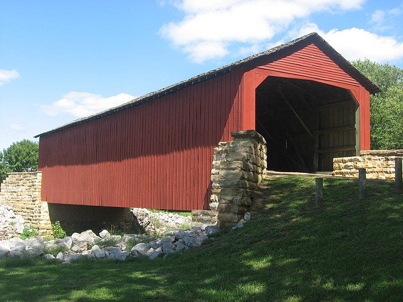
English: Southern portal and western side of the Mary's River Covered Bridge, which carries the old roadbed of Illinois Route 150 over the Little Marys River north of Chester in Randolph County, Illinois, United States. Built in 1854, it is listed on the National Register of Historic Places. |
||
| Date | Taken on 8 September 2012 | ||
| Source | Own work | ||
| Author | Nyttend | ||
| Permission (Reusing this file) |
|
File history
Click on a date/time to view the file as it appeared at that time.
| Date/Time | Thumbnail | Dimensions | User | Comment | |
|---|---|---|---|---|---|
| current | 21:31, 7 October 2012 | | 2,816 × 2,112 (2.57 MB) | Nyttend | {{NRHP|74000771}} {{Location|37|56|54|N|89|45|57|W}} {{Information |Description={{en|Southern portal and western side of the {{w|Mary's River Covered Bridge}}, which carries the old roadbed of {{w|Illinois Route 150}} over the {{w|Little Marys River (I... |
File usage
The following pages on the English Wikipedia use this file (pages on other projects are not listed):
Global file usage
The following other wikis use this file:
- Usage on am.wikipedia.org
- Usage on ban.wikipedia.org
- Usage on ceb.wikipedia.org
- Usage on cv.wikipedia.org
- Usage on de.wikipedia.org
- Usage on el.wikipedia.org
- Usage on frp.wikipedia.org
- Usage on id.wikipedia.org
- Usage on nn.wikipedia.org
- Usage on se.wikipedia.org
- Usage on te.wikipedia.org
- Usage on wa.wikipedia.org
- Usage on www.wikidata.org