
File:Milford (Junction) railway station (site), Yorkshire (geograph 6534198).jpg
Size of this preview: 800 × 600 pixels. Other resolutions: 320 × 240 pixels | 640 × 480 pixels | 1,024 × 768 pixels | 1,116 × 837 pixels.
Original file (1,116 × 837 pixels, file size: 316 KB, MIME type: image/jpeg)
| This is a file from the Wikimedia Commons. Information from its description page there is shown below. Commons is a freely licensed media file repository. You can help. |
_railway_station_(site),_Yorkshire_(geograph_6534198).jpg)
Summary
| Description |
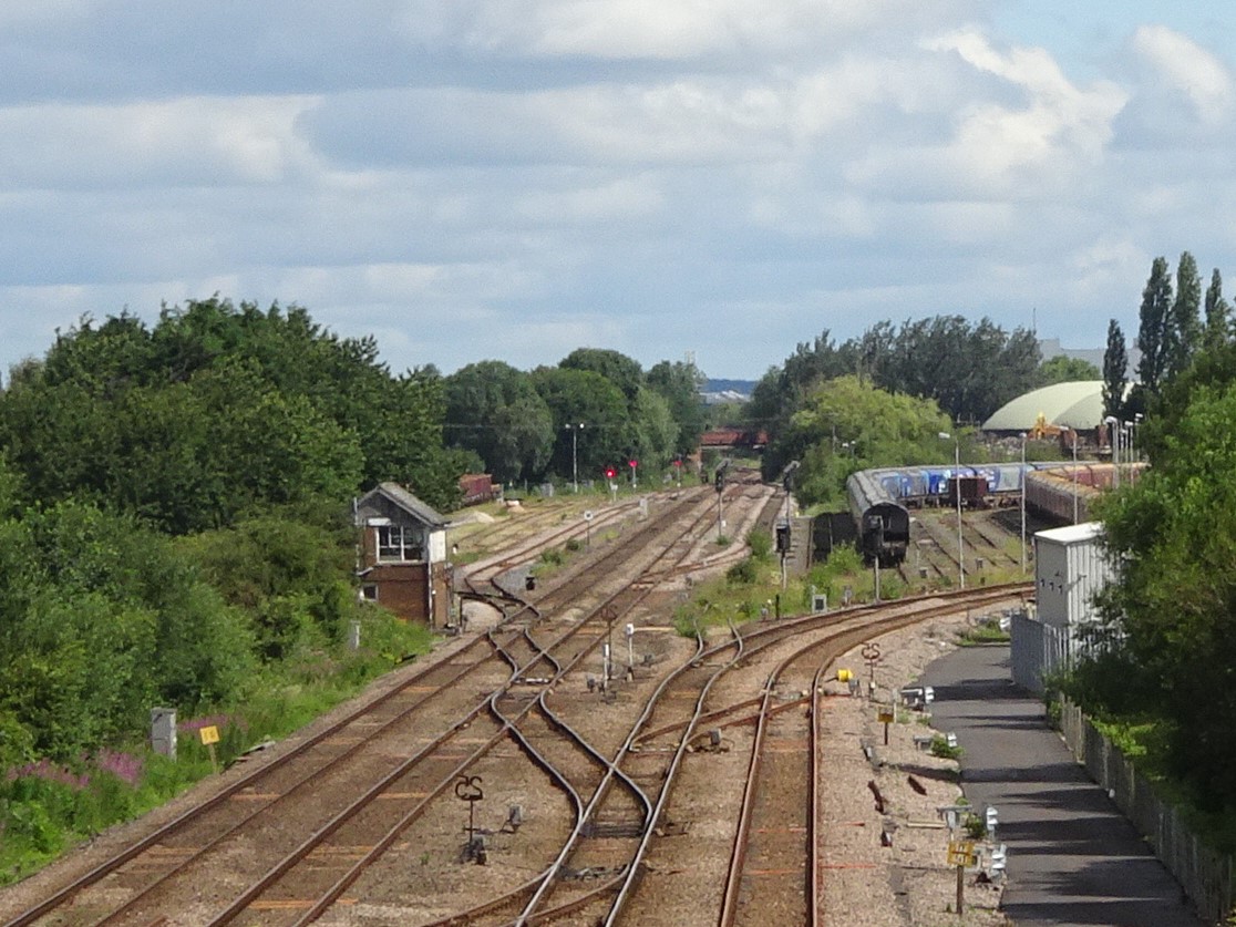
English: Milford (Junction) railway station (site), Yorkshire Opened in 1840 by the York & North Midland Railway on the line from York to Castleford, this station closed in 1904 when it was replaced by Monk Fryston station (a few hundred metres behind the camera position). It was known as "Milford Junction" until 1893. View north towards Sherburn-in-Elmet and York. The station was just beyond and to the right of the signal box, but all trace of it has apparently disappeared over the years as the area was used for sidings when this image was taken. |
| Date | |
| Source | From geograph.org.uk |
| Author | Nigel Thompson |
| Permission (Reusing this file) |
Creative Commons Attribution Share-alike license 2.0 |
| Attribution (required by the license) | Nigel Thompson / Milford (Junction) railway station (site), Yorkshire / |
| Camera location | | View this and other nearby images on: OpenStreetMap |
|---|
_railway_station_(site),_Yorkshire_(geograph_6534198).jpg¶ms=053.763492_N_-001.240124_E_globe:Earth_type:camera_source:geograph-osgb36(SE50192995)_heading:0.00&language=en)
| Object location | | View this and other nearby images on: OpenStreetMap |
|---|
_railway_station_(site),_Yorkshire_(geograph_6534198).jpg¶ms=053.771200_N_-001.237410_E_globe:Earth_class:object_type:object_source:geograph-osgb36(SE50363081)_heading:0.00&language=en)
Licensing

|
This image was taken from the Geograph project collection. See this photograph's page on the Geograph website for the photographer's contact details. The copyright on this image is owned by Nigel Thompson and is licensed for reuse under the Creative Commons Attribution-ShareAlike 2.0 license.
|
This file is licensed under the Creative Commons Attribution-Share Alike 2.0 Generic license.
Attribution: Nigel Thompson
- You are free:
- to share – to copy, distribute and transmit the work
- to remix – to adapt the work
- Under the following conditions:
- attribution – You must give appropriate credit, provide a link to the license, and indicate if changes were made. You may do so in any reasonable manner, but not in any way that suggests the licensor endorses you or your use.
- share alike – If you remix, transform, or build upon the material, you must distribute your contributions under the same or compatible license as the original.
File history
Click on a date/time to view the file as it appeared at that time.
| Date/Time | Thumbnail | Dimensions | User | Comment | |
|---|---|---|---|---|---|
| current | 09:43, 29 July 2020 | | 1,116 × 837 (316 KB) | Lamberhurst | Transferred from geograph.co.uk using [https://tools.wmflabs.org/geograph2commons/ geograph2commons] |
File usage
The following pages on the English Wikipedia use this file (pages on other projects are not listed):
Global file usage
The following other wikis use this file:
- Usage on www.wikidata.org
_railway_station_(site),_Yorkshire_(geograph_6534198).jpg)