
File:Muckanaghederdauhaulia.png
Size of this preview: 450 × 600 pixels. Other resolutions: 180 × 240 pixels | 360 × 480 pixels | 576 × 768 pixels | 768 × 1,024 pixels | 1,500 × 2,000 pixels.
Original file (1,500 × 2,000 pixels, file size: 204 KB, MIME type: image/png)
| This is a file from the Wikimedia Commons. Information from its description page there is shown below. Commons is a freely licensed media file repository. You can help. |
Summary
| Description |
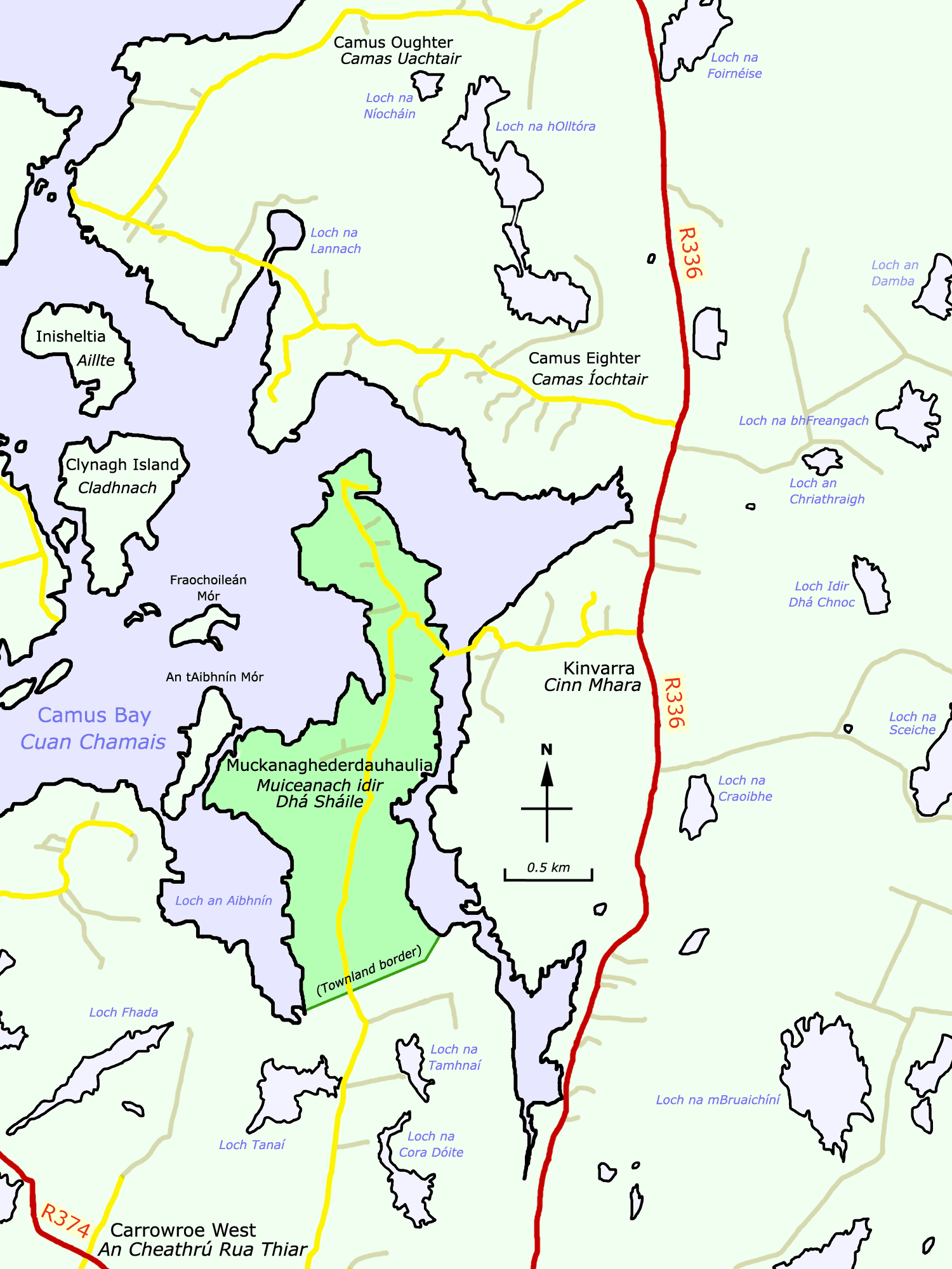
English: The peninsular townland of Muckanaghederdauhaulia (Irish:Muiceanach idir Dhá Sháile) in Camus Bay on the Atlantic seaboard of County Galway in Ireland is indicated by the darker shade of green on this map. Features are labelled in both the English and Irish languages. Regional roads appear in red; local roads in yellow; and minor roads (boreens) in brown. The townland is 1.4 km (0.87 miles) long and 0.75 km (0.47 miles) across at its widest, equivalent to 190 hectares (470 acres). |
| Date | |
| Source | Own work |
| Author | User:O'Dea |
| Other versions |
 |
| Camera location | | View this and other nearby images on: OpenStreetMap |
|---|
Licensing
I, the copyright holder of this work, hereby publish it under the following license:
This file is licensed under the Creative Commons Attribution-Share Alike 4.0 International license.
Attribution: © O'Dea at Wikimedia Commons, CC BY-SA 4.0
- You are free:
- to share – to copy, distribute and transmit the work
- to remix – to adapt the work
- Under the following conditions:
- attribution – You must give appropriate credit, provide a link to the license, and indicate if changes were made. You may do so in any reasonable manner, but not in any way that suggests the licensor endorses you or your use.
- share alike – If you remix, transform, or build upon the material, you must distribute your contributions under the same or compatible license as the original.
File history
Click on a date/time to view the file as it appeared at that time.
| Date/Time | Thumbnail | Dimensions | User | Comment | |
|---|---|---|---|---|---|
| current | 22:40, 4 January 2011 | | 1,500 × 2,000 (204 KB) | Spideog | {{Information |Description={{en|1=The peninsular townland of Muckanaghederdauhaulia (Irish:''Muiceanach idir Dhá Sháile'') in Camus Bay on the Atlantic seaboard of [[:en:County Galwa |
File usage
The following pages on the English Wikipedia use this file (pages on other projects are not listed):
Global file usage
The following other wikis use this file:
- Usage on fi.wikipedia.org
- Usage on fr.wikipedia.org
- Usage on ga.wikipedia.org
- Usage on ja.wikipedia.org
- Usage on www.wikidata.org