
File:Old Apple Tree Park map detail, from- Fort Vancouver National Historic Site Area Map (cropped).jpeg

Size of this preview: 749 × 599 pixels. Other resolutions: 300 × 240 pixels | 600 × 480 pixels | 960 × 768 pixels | 1,280 × 1,024 pixels | 2,119 × 1,696 pixels.
Original file (2,119 × 1,696 pixels, file size: 275 KB, MIME type: image/jpeg)
| This is a file from the Wikimedia Commons. Information from its description page there is shown below. Commons is a freely licensed media file repository. You can help. |
Summary
| Description |
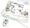
English: Fort Vancouver National Historic Site Area Map |
|||
| Date | Unknown date | |||
| Source | https://www.nps.gov/fova/planyourvisit/maps.htm | |||
| Author | National Park Service | |||
| Permission (Reusing this file) |
|
|||
| Other versions |
.jpeg)
File history
Click on a date/time to view the file as it appeared at that time.
| Date/Time | Thumbnail | Dimensions | User | Comment | |
|---|---|---|---|---|---|
| current | 16:35, 19 August 2020 | | 2,119 × 1,696 (275 KB) | Tibet Nation | File:Fort Vancouver National Historic Site Area Map.pdf cropped 57 % horizontally, 63 % vertically using CropTool with precise mode. |
File usage
The following pages on the English Wikipedia use this file (pages on other projects are not listed):
.jpeg)