
File:Pancham Mehta Vav 1.jpg
Size of this preview: 800 × 600 pixels. Other resolutions: 320 × 240 pixels | 640 × 480 pixels | 1,024 × 768 pixels | 1,280 × 960 pixels | 2,560 × 1,920 pixels | 5,184 × 3,888 pixels.
Original file (5,184 × 3,888 pixels, file size: 6.48 MB, MIME type: image/jpeg)
| This is a file from the Wikimedia Commons. Information from its description page there is shown below. Commons is a freely licensed media file repository. You can help. |
Summary
| Description |
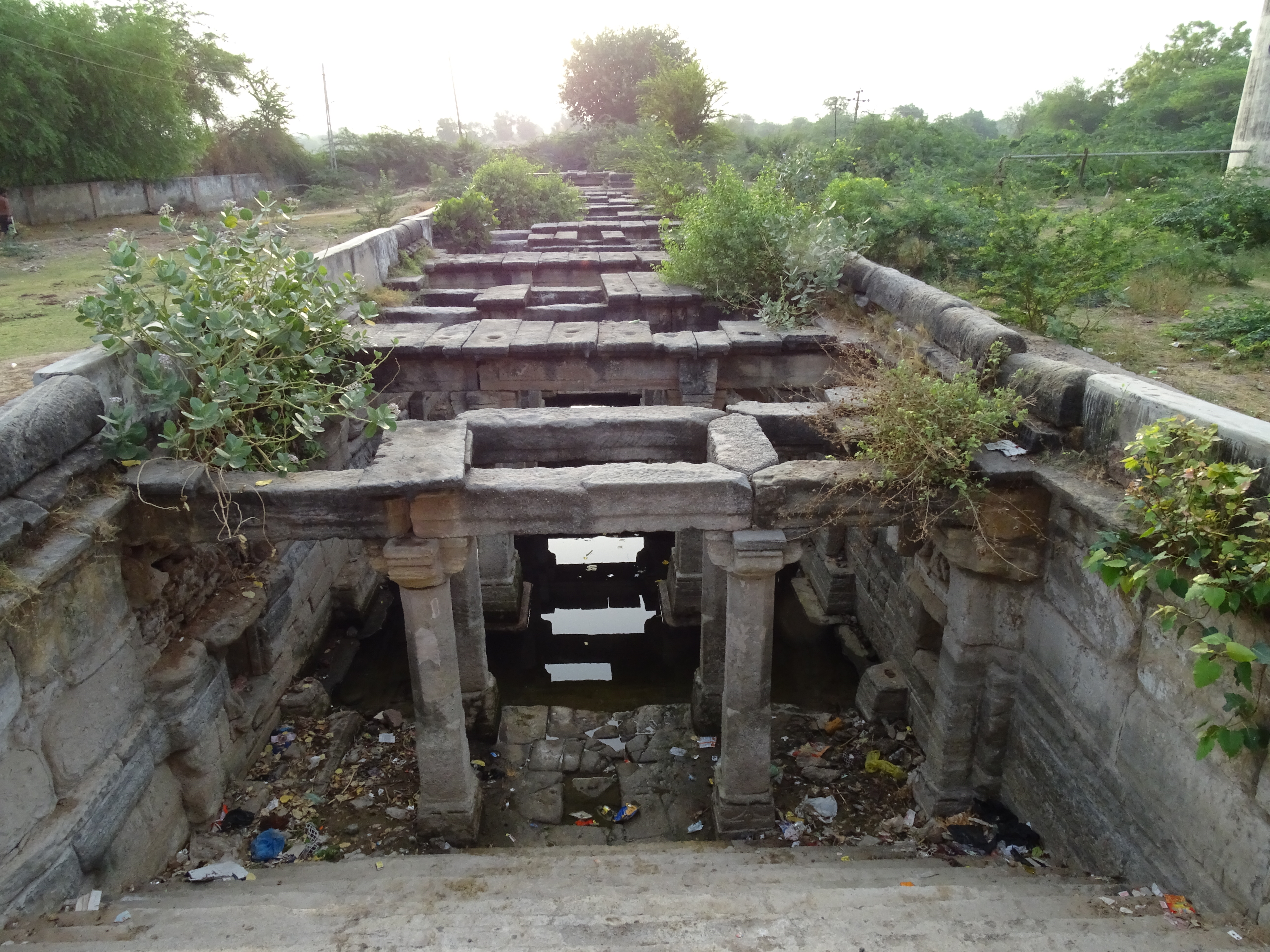
English: Situated just outside the historic fortified city of Vadnagar (Gujarat) is the Pancham Mehta's Vav. The exact date of its construction is unknown but sources date it back to either 16th or mid-18th century CE. The fact that it was constructed outside the fortified town suggests that it was built for public welfare while the name suggests that it may have been commissioned by a local leader as the town was never under a direct administration from a king. It is a ‘Nanda’ style 7 storied sub-terranean structure with a single flight of steps leading to the lower levels. Unlike the other Vavs in the vicinity this Vav has double shafts located at the eastern end and a domed pavilion at the western end leading to the steps. The Vav has a system of small channels emerging from the southern end which terminate in a small kund probably to be used by cattle or horses of travelling caravans. |
| Date | |
| Source | Own work |
| Author | BokiPikle |
| Camera location | | View this and other nearby images on: OpenStreetMap |
|---|
Licensing
I, the copyright holder of this work, hereby publish it under the following license:
This file is licensed under the Creative Commons Attribution-Share Alike 4.0 International license.
- You are free:
- to share – to copy, distribute and transmit the work
- to remix – to adapt the work
- Under the following conditions:
- attribution – You must give appropriate credit, provide a link to the license, and indicate if changes were made. You may do so in any reasonable manner, but not in any way that suggests the licensor endorses you or your use.
- share alike – If you remix, transform, or build upon the material, you must distribute your contributions under the same or compatible license as the original.

|
This image was uploaded as part of Wiki Loves Monuments 2022.
|
 |
File history
Click on a date/time to view the file as it appeared at that time.
| Date/Time | Thumbnail | Dimensions | User | Comment | |
|---|---|---|---|---|---|
| current | 14:26, 18 September 2022 | | 5,184 × 3,888 (6.48 MB) | BokiPikle | Uploaded own work with UploadWizard |
File usage
The following pages on the English Wikipedia use this file (pages on other projects are not listed):
Global file usage
The following other wikis use this file: