
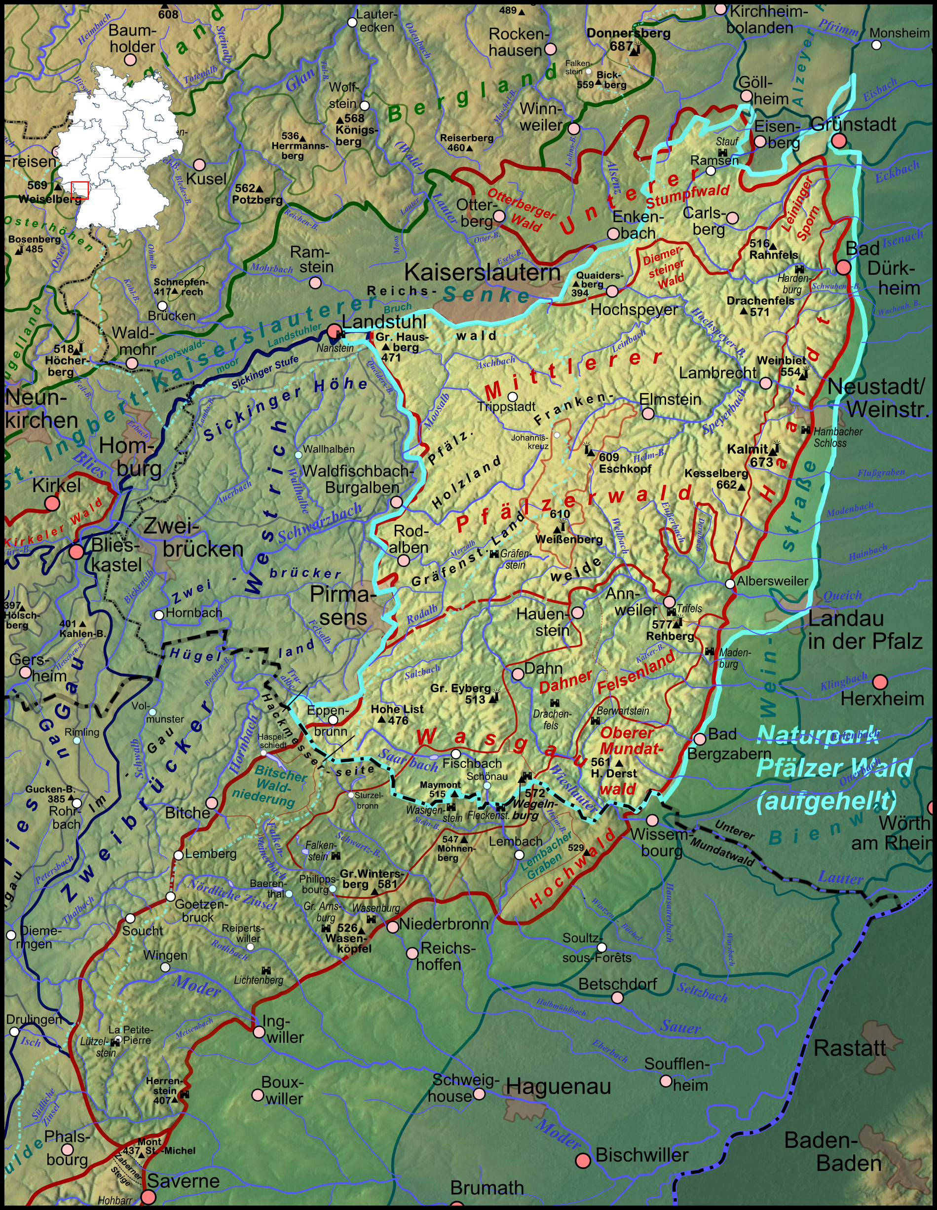
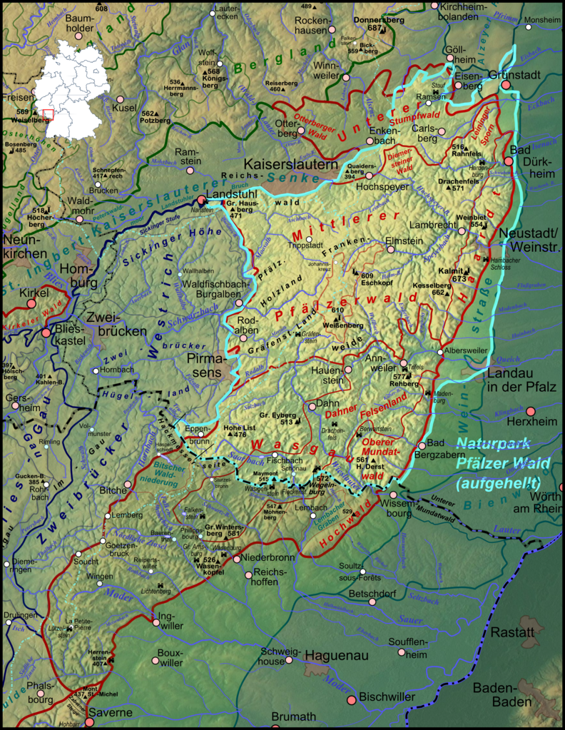
File:Pfaelzerwaldkarte Naturpark.png
Size of this preview: 464 × 600 pixels. Other resolutions: 186 × 240 pixels | 371 × 480 pixels | 594 × 768 pixels | 792 × 1,024 pixels | 1,899 × 2,454 pixels.
Original file (1,899 × 2,454 pixels, file size: 7.33 MB, MIME type: image/png)
| This is a file from the Wikimedia Commons. Information from its description page there is shown below. Commons is a freely licensed media file repository. You can help. |
Summary
| Description |
Deutsch: Karte des Naturparks Pfälzerwald (aufgehellt) auf Basis der naturräumlichen Gliederung nach Pemöller und der Gliederung nach Geiger, siehe naturräumlich orientierte Karte |
| Date | |
| Source |
Own work
|
| Author | Elop, based on work by Lencer |
| Other versions |
|
Licensing

|
Permission is granted to copy, distribute and/or modify this document under the terms of the GNU Free Documentation License, Version 1.2 or any later version published by the Free Software Foundation; with no Invariant Sections, no Front-Cover Texts, and no Back-Cover Texts. A copy of the license is included in the section entitled GNU Free Documentation License. |
File history
Click on a date/time to view the file as it appeared at that time.
| Date/Time | Thumbnail | Dimensions | User | Comment | |
|---|---|---|---|---|---|
| current | 21:51, 8 February 2012 | | 1,899 × 2,454 (7.33 MB) | Elop | komplettes Update |
| 21:13, 16 December 2011 |  | 1,382 × 1,137 (2.34 MB) | Elop | Update | |
| 15:18, 14 December 2011 |  | 1,382 × 1,137 (2.33 MB) | Elop | k | |
| 13:26, 13 December 2011 |  | 1,382 × 1,137 (2.34 MB) | Elop | Hervorhebung geändert | |
| 02:33, 12 December 2011 |  | 1,382 × 1,137 (2.25 MB) | Elop | insbesondere Ortsstruktur | |
| 18:27, 8 December 2011 |  | 1,382 × 1,137 (2.21 MB) | Elop | update | |
| 00:42, 1 December 2011 |  | 1,343 × 1,130 (2.11 MB) | Elop | == Summary == {{Information |Description ={{de|1=Karte des Naturparks Pfälzerwald (farblich hervorgehoben) auf Basis der naturräumlichen Gliederung nach Pemöller und der Gliederung nach Geiger, siehe [[:Datei:Pfaelzerw |
File usage
The following pages on the English Wikipedia use this file (pages on other projects are not listed):
Global file usage
The following other wikis use this file:
- Usage on de.wikipedia.org
- Usage on eo.wikipedia.org
- Usage on nl.wikipedia.org
- Usage on pfl.wikipedia.org