
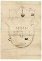
File:Plan of Fort Powhatan, Prince George County, Virginia LOC lva0000190.jpg

Size of this preview: 418 × 599 pixels. Other resolutions: 167 × 240 pixels | 335 × 480 pixels | 536 × 768 pixels | 714 × 1,024 pixels | 1,428 × 2,048 pixels | 4,855 × 6,960 pixels.
Original file (4,855 × 6,960 pixels, file size: 3.4 MB, MIME type: image/jpeg)
| This is a file from the Wikimedia Commons. Information from its description page there is shown below. Commons is a freely licensed media file repository. You can help. |
Summary
| Description |
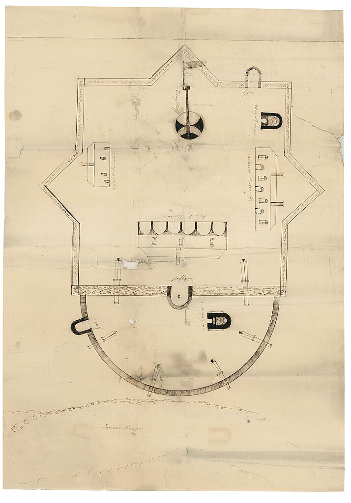
English: Plan of Fort Powhatan (1819), also called Fort Hood, was on Hood's plantation on the James River in Virginia. This fort was built in 1808 on the site of Hood's Battery from the American Revolutionary War.
Original map located in House of Delegates, Office of the Speaker, Executive Communications, Oversized, Box 9, Folder 14. Although included in a report of 1821, this plan represents the fort as it looked in 1819, before the cannon was removed. This item is in the Map Collection of the Library of Virginia; please contact the Library's Archives Research Services department for more information. Available also through the Library of Congress web site as raster image. C. 1, Sept. 1969, photocopy, LVA; c. 2, 2004, color ink jet, LVA (original in Archives); March 2004, Map Cataloging Team. Civil War project no.: lva00190. Conservation: Etherington Conservation Center, Jan. 2004. Copy 1: Map accession no. 2911 (1969), (negative photostat, LVA, Sept. 1969, aprox. 43 x 60 cm.) Digital image available: 22 x 15.7 in. Previously filed as: 755.61 M6 1861-1865 1819 (1). |
||
| Title | [Plan of Fort Powhatan, Prince George County, Virginia | ||
| Shelf ID | https://www.loc.gov/item/lva0000190/ | ||
| Date | |||
| Source | https://www.loc.gov/item/lva0000190/ | ||
| Author | Lt. Elijah Brown | ||
| Permission (Reusing this file) |
|
||
| Other versions |
|
||
| Location | United States · Fort Powhatan · Prince George County · Virginia · Fort Powhatan (Prince George County) | ||
| Part of | Military Battles And Campaigns · American Memory · Civil War Maps · Geography And Map Division | ||
| Subject | Fort Powhatan (Prince George County, Va.) · Maps, Manuscript · Prince George County · Fort Powhatan (Prince George County) · Virginia · United States · Fortifications |

Licensing
|
This is a faithful photographic reproduction of a two-dimensional, public domain work of art. The work of art itself is in the public domain for the following reason:
The official position taken by the Wikimedia Foundation is that "faithful reproductions of two-dimensional public domain works of art are public domain".
This photographic reproduction is therefore also considered to be in the public domain in the United States. In other jurisdictions, re-use of this content may be restricted; see Reuse of PD-Art photographs for details. | ||||
File history
Click on a date/time to view the file as it appeared at that time.
| Date/Time | Thumbnail | Dimensions | User | Comment | |
|---|---|---|---|---|---|
| current | 05:34, 18 May 2018 | | 4,855 × 6,960 (3.4 MB) | Fæ | LOC Maps https://www.loc.gov/item/lva0000190/ #10580 |
File usage
The following pages on the English Wikipedia use this file (pages on other projects are not listed):
Global file usage
The following other wikis use this file:
- Usage on www.wikidata.org