File:Polarbanen ved Hamarøy.jpg

Page contents not supported in other languages.
This is a file from the Wikimedia Commons
From Wikipedia, the free encyclopedia

Polarbanen_ved_Hamarøy.jpg(640 × 453 pixels, file size: 48 KB, MIME type: image/jpeg)

Description
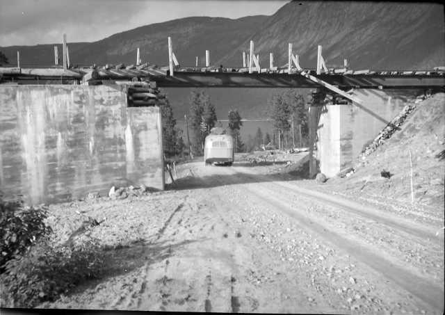
English: Polar Line at Hamarøy, Norway
Date
Source Galleri NOR Tilvekstnummer: SLHL 1947/016 Internnr: NBR9809:01468
Author
Lyder Kvantoland  (1893–1972)  wikidata:Q16063523
 
Lyder Kvantoland
Description Norwegian photographer, local historian and writer
Date of birth/death 28 July 1893 Edit this at Wikidata 1972 Edit this at Wikidata
Location of birth Sørfold Municipality
Authority file
creator QS:P170,Q16063523
Permission
(Reusing this file)
Public domain This image is in the public domain in Norway because images not considered to be "works of art" become public domain 50 years after creation, provided that more than 15 years have passed since the photographer's death or the photographer is unknown.

This is according to § 23 in the Norwegian Åndsverkloven.

Under the former photo law, protection ended 25 years after creation, provided that more than 15 years had passed since the photographer's death or the photographer is unknown. The image is in the public domain if the protection ended before 29 June 1995 under the older term.[1]


To uploader: Please provide information about where the image was first published, who created it, and when the photographer died, if known. The right to be attributed does not expire in Norway.

Images uploaded to Wikimedia Commons must also be in the public domain in the United States. A Norwegian work that is in the public domain in Norway is in the public domain in the U.S. only if it was in the public domain in Norway in 1996 and no copyright was registered in the U.S. (This is the effect of 17 USC 104A with its critical date of January 1, 1996.)


Deutsch | English | македонски | Nederlands | norsk nynorsk | +/−

Camera location67° 50′ 08.47″ N, 16° 00′ 01.16″ E Kartographer map based on OpenStreetMap.View this and other nearby images on: OpenStreetMapinfo

Captions

Add a one-line explanation of what this file represents

Items portrayed in this file

depicts

67°50'8.470"N, 16°0'1.163"E

image/jpeg

File history

Click on a date/time to view the file as it appeared at that time.

Date/TimeThumbnailDimensionsUserComment
current08:31, 12 June 2011Thumbnail for version as of 08:31, 12 June 2011640 × 453 (48 KB)Arsenikk{{Information |Description ={{en|1=Polar Line at Hamarøy, Norway}} |Source =[http://www.nb.no/cgi-bin/galnor/gn_sok.sh?id=189497&skjema=2&fm=4 Galleri NOR] Tilvekstnummer: SLHL 1947/016 Internnr: NBR9809:01468 |Author ={{Creator:Lyder
The following pages on the English Wikipedia use this file (pages on other projects are not listed):

Global file usage

The following other wikis use this file:

Metadata