
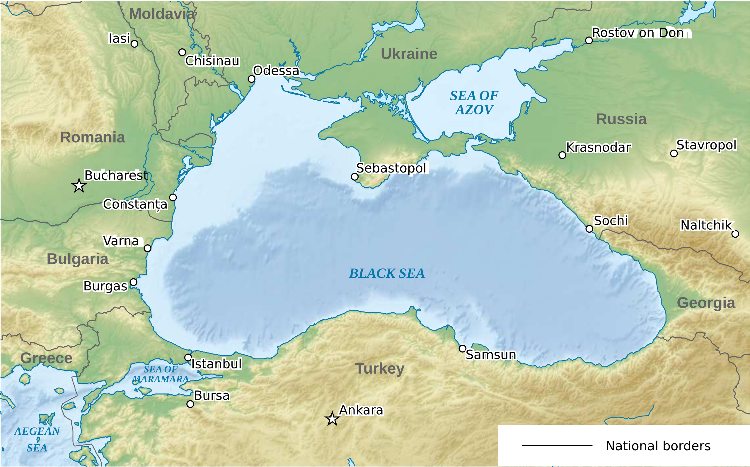
File:Relief map of the Black Sea.svg

Size of this PNG preview of this SVG file: 532 × 331 pixels. Other resolutions: 320 × 199 pixels | 640 × 398 pixels | 1,024 × 637 pixels | 1,280 × 796 pixels | 2,560 × 1,593 pixels.
Original file (SVG file, nominally 532 × 331 pixels, file size: 4.59 MB)
| This is a file from the Wikimedia Commons. Information from its description page there is shown below. Commons is a freely licensed media file repository. You can help. |
| Description | Relief map of the Black Sea | ||
| Date | |||
| Source | |||
| Author |
|
||
| Permission (Reusing this file) |
I, the copyright holder of this work, hereby publish it under the following licenses:
This file is licensed under the Creative Commons Attribution-Share Alike Attribution-Share Alike 4.0 International, 3.0 Unported, 2.5 Generic, 2.0 Generic and 1.0 Generic license.
You may select the license of your choice. |
.svg)
| This is a retouched picture, which means that it has been digitally altered from its original version. Modifications: Translated from German into English and removed lines in the sea, Übergesetzen von Deutsch auf Englisch und gelöscht seegrenzen. The original can be viewed here: Ausschliessliche Wirtschaftszonen Schwarzes Meer (Reliefkarte).svg:
|
File history
Click on a date/time to view the file as it appeared at that time.
| Date/Time | Thumbnail | Dimensions | User | Comment | |
|---|---|---|---|---|---|
| current | 23:51, 18 March 2014 | | 532 × 331 (4.59 MB) | Hogweard | {{Information |Description=Relief map of the Black Sea |Source=*Ausschliessliche Wirtschaftszonen Schwarzes Meer (Reliefkarte).svg |Date=2014-03-18 |Author=*[[:File:Ausschlies... |
.svg)
File usage
No pages on the English Wikipedia use this file (pages on other projects are not listed).
Global file usage
The following other wikis use this file:
- Usage on ro.wikipedia.org
- Usage on sc.wikipedia.org
- Usage on tr.wikipedia.org