
File:Road 200 at Grassy Point.jpg

Size of this preview: 800 × 532 pixels. Other resolutions: 320 × 213 pixels | 640 × 426 pixels | 1,024 × 681 pixels | 1,280 × 851 pixels | 2,560 × 1,702 pixels | 6,016 × 4,000 pixels.
Original file (6,016 × 4,000 pixels, file size: 7.14 MB, MIME type: image/jpeg)
| This is a file from the Wikimedia Commons. Information from its description page there is shown below. Commons is a freely licensed media file repository. You can help. |
| Camera location | | View this and other nearby images on: OpenStreetMap |
|---|
| Description |
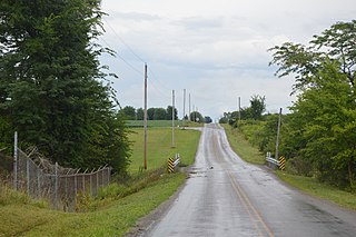
English: Looking east along County Road 200 just east of State Route 292 in northwestern Hale Township, Hardin County, Ohio, United States. Now empty, this location was once known as "Grassy Point". |
||
| Date | Taken on 15 August 2016 | ||
| Source | Own work | ||
| Author | Nyttend | ||
| Permission (Reusing this file) |
|
File history
Click on a date/time to view the file as it appeared at that time.
| Date/Time | Thumbnail | Dimensions | User | Comment | |
|---|---|---|---|---|---|
| current | 01:27, 21 August 2016 | | 6,016 × 4,000 (7.14 MB) | Nyttend | {{Location|40|33|34|N|83|35|14|W}} {{Information |Description={{en|Looking east along County Road 200 just east of {{w|Ohio State Route 292|State Route 292}} in northwestern {{w|Hale Township, Hardin County, Ohio|Hale Township}}, {{w|Hardin County, Ohi... |
File usage
The following pages on the English Wikipedia use this file (pages on other projects are not listed):