
File:Rochdale Canal at Newton Heath - geograph.org.uk - 1551.jpg
No higher resolution available.
Rochdale_Canal_at_Newton_Heath_-_geograph.org.uk_-_1551.jpg (640 × 480 pixels, file size: 45 KB, MIME type: image/jpeg)
| This is a file from the Wikimedia Commons. Information from its description page there is shown below. Commons is a freely licensed media file repository. You can help. |
Summary
| Description |
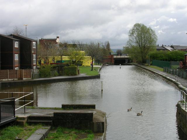
English: Rochdale Canal at Newton Heath. Here the Rochdale Canal runs through the town of Newton Heath, Manchester. This stretch sits between locks 69 & 70. The yellow building in the distance is the town library. In the past Newton Heath was a centre of industry. It is famous as the place where Manchester United Football Club was formed by a group of railway workers in 1879. |
| Date | |
| Source | From geograph.org.uk |
| Author | Keith Williamson |
| Attribution (required by the license) | Keith Williamson / Rochdale Canal at Newton Heath / |
| Camera location | | View this and other nearby images on: OpenStreetMap |
|---|
_heading:67.00&language=en)
| Object location | | View this and other nearby images on: OpenStreetMap |
|---|
_heading:67.00&language=en)
Licensing

|
This image was taken from the Geograph project collection. See this photograph's page on the Geograph website for the photographer's contact details. The copyright on this image is owned by Keith Williamson and is licensed for reuse under the Creative Commons Attribution-ShareAlike 2.0 license.
|
This file is licensed under the Creative Commons Attribution-Share Alike 2.0 Generic license.
Attribution: Keith Williamson
- You are free:
- to share – to copy, distribute and transmit the work
- to remix – to adapt the work
- Under the following conditions:
- attribution – You must give appropriate credit, provide a link to the license, and indicate if changes were made. You may do so in any reasonable manner, but not in any way that suggests the licensor endorses you or your use.
- share alike – If you remix, transform, or build upon the material, you must distribute your contributions under the same or compatible license as the original.
File history
Click on a date/time to view the file as it appeared at that time.
| Date/Time | Thumbnail | Dimensions | User | Comment | |
|---|---|---|---|---|---|
| current | 03:21, 30 January 2010 | | 640 × 480 (45 KB) | GeographBot | == {{int:filedesc}} == {{Information |description={{en|1=Rochdale Canal at Newton Heath. Here the Rochdale Canal runs through the town of Newton Heath, Manchester. This stretch sits between locks 69 & 70. The yellow building in the distance is the town li |
File usage
The following pages on the English Wikipedia use this file (pages on other projects are not listed):