
File:Roe deer in Islands Thorns Inclosure, New Forest - geograph.org.uk - 386735.jpg
No higher resolution available.
Roe_deer_in_Islands_Thorns_Inclosure,_New_Forest_-_geograph.org.uk_-_386735.jpg (640 × 480 pixels, file size: 110 KB, MIME type: image/jpeg)
| This is a file from the Wikimedia Commons. Information from its description page there is shown below. Commons is a freely licensed media file repository. You can help. |
Summary
| Description |
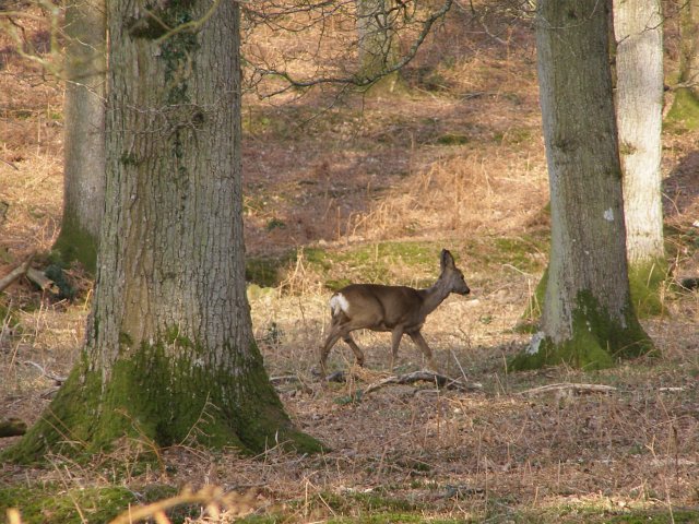
English: Roe deer in Islands Thorns Inclosure, New Forest This is a relatively remote part of the New Forest, easier to stumble across deer. The crisp leaves and twigs underfoot mean that they hear you coming before you can get too close but there are plenty of trees to hide behind. Just north of here is Studley Castle, the site of a medieval royal hunting lodge. The New Forest (Nova Foresta) was created in 1079 by William the Conqueror, and the area was subject to forest law to protect the creatures of the chase and their habitat. Things had changed a lot by 1851 when the Deer Removal Act was passed by parliament and, officially, all the deer were culled. Nowadays the deer population is 'controlled' by Forest Keepers who shoot carefully selected individuals using high-velocity rifles. Roe deer, like the female in this photograph, browse on tree shoots and shrubs. In the winter this puts them in competition with the commoners' stock, and thus there is pressure from the commoners to limit the deer population. |
| Date | |
| Source | From geograph.org.uk |
| Author | Jim Champion |
| Attribution (required by the license) | Jim Champion / Roe deer in Islands Thorns Inclosure, New Forest / |
| Camera location | | View this and other nearby images on: OpenStreetMap |
|---|
_heading:22.00&language=en)
| Object location | | View this and other nearby images on: OpenStreetMap |
|---|
_heading:22.00&language=en)
Licensing

|
This image was taken from the Geograph project collection. See this photograph's page on the Geograph website for the photographer's contact details. The copyright on this image is owned by Jim Champion and is licensed for reuse under the Creative Commons Attribution-ShareAlike 2.0 license.
|
This file is licensed under the Creative Commons Attribution-Share Alike 2.0 Generic license.
Attribution: Jim Champion
- You are free:
- to share – to copy, distribute and transmit the work
- to remix – to adapt the work
- Under the following conditions:
- attribution – You must give appropriate credit, provide a link to the license, and indicate if changes were made. You may do so in any reasonable manner, but not in any way that suggests the licensor endorses you or your use.
- share alike – If you remix, transform, or build upon the material, you must distribute your contributions under the same or compatible license as the original.
File history
Click on a date/time to view the file as it appeared at that time.
| Date/Time | Thumbnail | Dimensions | User | Comment | |
|---|---|---|---|---|---|
| current | 14:59, 3 February 2011 | | 640 × 480 (110 KB) | GeographBot | == {{int:filedesc}} == {{Information |description={{en|1=Roe deer in Islands Thorns Inclosure, New Forest This is a relatively remote part of the New Forest, easier to stumble across deer. The crisp leaves and twigs underfoot mean that they hear you comin |
File usage
The following pages on the English Wikipedia use this file (pages on other projects are not listed):