
File:Ruins Sherriff's Pit - geograph.org.uk - 536971.jpg
No higher resolution available.
Ruins_Sherriff's_Pit_-_geograph.org.uk_-_536971.jpg (640 × 427 pixels, file size: 79 KB, MIME type: image/jpeg)
| This is a file from the Wikimedia Commons. Information from its description page there is shown below. Commons is a freely licensed media file repository. You can help. |
Summary
| Description |
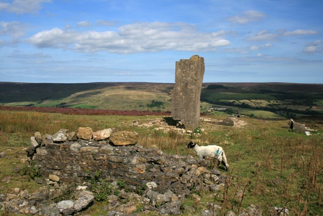
English: Ruins Sherriff's Pit Sherriff's Pit was quite unusual amongst the Rosedale ironstone mines in that it ore was extracted via a shaft. The pit was named after a partner in the original mining company, an Alexander Clunes Sheriff. The royalty was first leased in 1857 with drifts into the hillside just above Medd's Farm (SE703968). One of these drifts was extended to the base of the 825' vertical shaft. A tramway carried the ore to the base of the shaft where it was hauled to the top and directly emptied into railway wagons without being calcinated. The mine closed between 1879 and 1881 due to the recession. It finally closed in 1911. |
| Date | |
| Source | From geograph.org.uk |
| Author | Mick Garratt |
| Attribution (required by the license) | Mick Garratt / Ruins Sherriff's Pit / |
| Camera location | | View this and other nearby images on: OpenStreetMap |
|---|
_heading:67.00&language=en)
| Object location | | View this and other nearby images on: OpenStreetMap |
|---|
_heading:67.00&language=en)
Licensing

|
This image was taken from the Geograph project collection. See this photograph's page on the Geograph website for the photographer's contact details. The copyright on this image is owned by Mick Garratt and is licensed for reuse under the Creative Commons Attribution-ShareAlike 2.0 license.
|
This file is licensed under the Creative Commons Attribution-Share Alike 2.0 Generic license.
Attribution: Mick Garratt
- You are free:
- to share – to copy, distribute and transmit the work
- to remix – to adapt the work
- Under the following conditions:
- attribution – You must give appropriate credit, provide a link to the license, and indicate if changes were made. You may do so in any reasonable manner, but not in any way that suggests the licensor endorses you or your use.
- share alike – If you remix, transform, or build upon the material, you must distribute your contributions under the same or compatible license as the original.
File history
Click on a date/time to view the file as it appeared at that time.
| Date/Time | Thumbnail | Dimensions | User | Comment | |
|---|---|---|---|---|---|
| current | 20:56, 5 February 2011 | | 640 × 427 (79 KB) | GeographBot | == {{int:filedesc}} == {{Information |description={{en|1=Ruins Sherriff's Pit Sherriff's Pit was quite unusual amongst the Rosedale ironstone mines in that it ore was extracted via a shaft. The pit was named after a partner in the original mining company, |
File usage
The following pages on the English Wikipedia use this file (pages on other projects are not listed):