
File:Ruins of Chailey Heritage Marine Hospital - geograph.org.uk - 1410294.jpg
No higher resolution available.
Ruins_of_Chailey_Heritage_Marine_Hospital_-_geograph.org.uk_-_1410294.jpg (640 × 480 pixels, file size: 56 KB, MIME type: image/jpeg)
| This is a file from the Wikimedia Commons. Information from its description page there is shown below. Commons is a freely licensed media file repository. You can help. |
Summary
| Description |
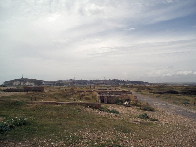
English: Ruins of Chailey Heritage Marine Hospital The hospital was built in 1924, to provide aftercare and recovery for disabled boys who had undergone surgery. Plaques on the site speak of a charitable foundation, the "Guild of the Poor Brave Things", that founded the hospital as part of the Chailey Heritage created by Dame Grace Kimmins in 1903. The nurses home was inland and the hospital built on foundations on the shingle beach itself
The ruins show very weathered concrete foundations onto which were fixed what appear to be wooden buildings. Plaques on the site show beds wheeled into the fresh air - "Nature's Antibiotic". Very close to, and on the landward side of the hospital, was the Lily Warren nurses' home. http://en.wikipedia.org/wiki/Chailey_Heritage_Marine_Hospital |
| Date | |
| Source | From geograph.org.uk |
| Author | Paul Gillett |
| Attribution (required by the license) | Paul Gillett / Ruins of Chailey Heritage Marine Hospital / |
| Camera location | | View this and other nearby images on: OpenStreetMap |
|---|
_heading:270.00&language=en)
| Object location | | View this and other nearby images on: OpenStreetMap |
|---|
_heading:270.00&language=en)
Licensing

|
This image was taken from the Geograph project collection. See this photograph's page on the Geograph website for the photographer's contact details. The copyright on this image is owned by Paul Gillett and is licensed for reuse under the Creative Commons Attribution-ShareAlike 2.0 license.
|
This file is licensed under the Creative Commons Attribution-Share Alike 2.0 Generic license.
Attribution: Paul Gillett
- You are free:
- to share – to copy, distribute and transmit the work
- to remix – to adapt the work
- Under the following conditions:
- attribution – You must give appropriate credit, provide a link to the license, and indicate if changes were made. You may do so in any reasonable manner, but not in any way that suggests the licensor endorses you or your use.
- share alike – If you remix, transform, or build upon the material, you must distribute your contributions under the same or compatible license as the original.
File history
Click on a date/time to view the file as it appeared at that time.
| Date/Time | Thumbnail | Dimensions | User | Comment | |
|---|---|---|---|---|---|
| current | 16:53, 1 March 2011 | | 640 × 480 (56 KB) | GeographBot | == {{int:filedesc}} == {{Information |description={{en|1=Ruins of Chailey Heritage Marine Hospital The hospital was built in 1924, to provide aftercare and recovery for disabled boys who had undergone surgery. Plaques on the site speak of a charitable fou |
File usage
The following pages on the English Wikipedia use this file (pages on other projects are not listed):
Global file usage
The following other wikis use this file:
- Usage on www.wikidata.org