
File:SAC - FAA airport diagram.png
Size of this preview: 390 × 599 pixels. Other resolutions: 156 × 240 pixels | 313 × 480 pixels | 806 × 1,237 pixels.
Original file (806 × 1,237 pixels, file size: 46 KB, MIME type: image/png)
| This is a file from the Wikimedia Commons. Information from its description page there is shown below. Commons is a freely licensed media file repository. You can help. |
Summary
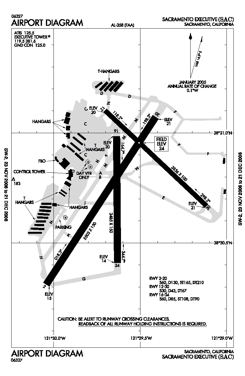
| Description | Out-Of-Date FAA airport diagram for SAC (Sacramento Executive Airport) in California, United States. Runway 16/34 has been permanently closed and demolished as of January 2022. |
| Date | Unknown date. Effective: 23 November 2006 - 21 December 2006 |
| Source | http://www.naco.faa.gov/index.asp?xml=naco/online/d_tpp |
| Author | United States Federal Aviation Administration |
| Permission (Reusing this file) |
Public Domain |
Licensing
This image or file is a work of a Federal Aviation Administration employee, taken or made as part of that person's official duties. As a work of the U.S. federal government, the image is in the public domain in the United States.
|
 |
File history
Click on a date/time to view the file as it appeared at that time.
| Date/Time | Thumbnail | Dimensions | User | Comment | |
|---|---|---|---|---|---|
| current | 22:14, 4 December 2006 | | 806 × 1,237 (46 KB) | Thadius856 | == Summary == {{Information| |Description = FAA airport diagram for SAC (Sacramento Executive Airport) in California, United States. |Source = http://www.naco.faa.gov/index.asp?xml=naco/online/d_tpp |Date = Unknown. Effective: 23 November 2006 - 21 Decemb |
File usage
The following pages on the English Wikipedia use this file (pages on other projects are not listed):
Global file usage
The following other wikis use this file:
- Usage on fa.wikipedia.org
- Usage on tg.wikipedia.org