
File:Salas pagasts (Babīte) LocMap.png
No higher resolution available.
Salas_pagasts_(Babīte)_LocMap.png (506 × 299 pixels, file size: 71 KB, MIME type: image/png)
| This is a file from the Wikimedia Commons. Information from its description page there is shown below. Commons is a freely licensed media file repository. You can help. |
_LocMap.png)
Summary
| Description |
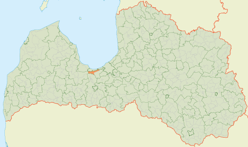
English: Location map of Sala parish, Babīte municipality in Latvia |
| Date | |
| Source |
Own work by the original uploader |
| Author | Kikos |
Licensing
| This work has been released into the public domain by its author, Kikos at Latvian Wikipedia. This applies worldwide. In some countries this may not be legally possible; if so: Kikos grants anyone the right to use this work for any purpose, without any conditions, unless such conditions are required by law. |
Original upload log
The original description page was here. All following user names refer to lv.wikipedia.
- 2009-11-01 18:33 Kikos 506×299 (72708 B) {{self}} [[Kategorija:Salas pagasts]] [[Kategorija:Latvijas pagastu kartes]]
File history
Click on a date/time to view the file as it appeared at that time.
| Date/Time | Thumbnail | Dimensions | User | Comment | |
|---|---|---|---|---|---|
| current | 10:04, 28 August 2011 | | 506 × 299 (71 KB) | Glossologist | {{Information |Description={{en|Location map of Sala parish, Babīte municipality, Latvia.}} |Source=Latvian Wikipedia |Date= Unknown |Author= lv:Lietotājs:Kikos |Permission={{PD-user|Kikos|lv}} |ot |
_LocMap.png)
File usage
The following pages on the English Wikipedia use this file (pages on other projects are not listed):
Global file usage
The following other wikis use this file:
- Usage on da.wikipedia.org
- Usage on et.wikipedia.org
- Usage on lv.wikipedia.org
- Usage on ru.wikipedia.org
- Usage on www.wikidata.org
_LocMap.png)