
File:Salies du Salat-Église Notre Dame de la Pitié-20130425.jpg
Size of this preview: 800 × 533 pixels. Other resolutions: 320 × 213 pixels | 640 × 427 pixels | 1,024 × 683 pixels | 1,280 × 853 pixels | 2,560 × 1,707 pixels | 4,200 × 2,800 pixels.
Original file (4,200 × 2,800 pixels, file size: 3.56 MB, MIME type: image/jpeg)
| This is a file from the Wikimedia Commons. Information from its description page there is shown below. Commons is a freely licensed media file repository. You can help. |
| Description |
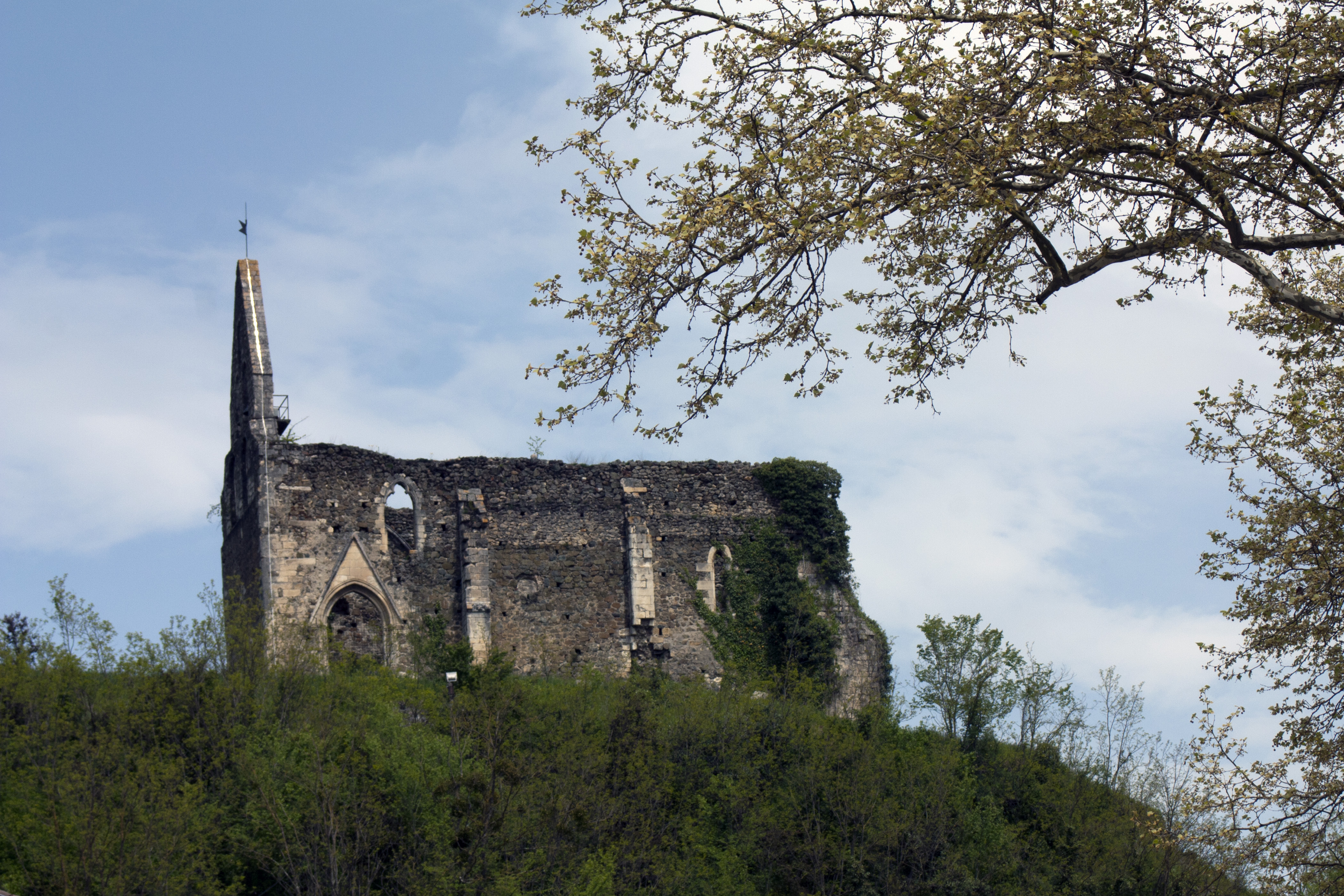
Ruins of the Church of Our Lady of Mercy, 14th century, destroyed in the same time as the castle of the Counts of Comminges which she was the chapel. | ||
| Protection |
|
||
| Date | Taken on 23 April 2014. | ||
| Source | Own work. | ||
| Author | Daniel VILLAFRUELA. | ||
| Permission (Reusing this file) |
Daniel VILLAFRUELA, the copyright holder of this work, hereby publishes it under the following license: This file is licensed under the Creative Commons Attribution-Share Alike 3.0 Unported license. Attribution: Daniel VILLAFRUELA
|
| Object location | | View this and other nearby images on: OpenStreetMap |
|---|
| Camera location | | View this and other nearby images on: OpenStreetMap |
|---|
File history
Click on a date/time to view the file as it appeared at that time.
| Date/Time | Thumbnail | Dimensions | User | Comment | |
|---|---|---|---|---|---|
| current | 20:05, 25 April 2013 | | 4,200 × 2,800 (3.56 MB) | Daniel VILLAFRUELA | =={{int:filedesc}}== {{Information |Description = {{mld |en= Ruins of the Church of Our Lady of Mercy, 14th century, destroyed in the same time as the castle of the Counts of Comminges which she was the chapel. |es=Ruinas de la Iglesia de Nuestra Señ... |
File usage
The following pages on the English Wikipedia use this file (pages on other projects are not listed):
Global file usage
The following other wikis use this file:
- Usage on ca.wikipedia.org
- Usage on ceb.wikipedia.org
- Usage on de.wikipedia.org
- Usage on es.wikipedia.org
- Usage on fr.wikipedia.org
- Usage on pt.wikipedia.org
- Usage on ru.wikipedia.org
- Usage on sq.wikipedia.org
- Usage on www.wikidata.org