
File:Satellite image of Spencer Gulf and Gulf St Vincent, South Australia (NASA image).png
Size of this preview: 600 × 600 pixels. Other resolutions: 240 × 240 pixels | 480 × 480 pixels | 768 × 768 pixels | 1,024 × 1,024 pixels | 2,151 × 2,151 pixels.
Original file (2,151 × 2,151 pixels, file size: 5.53 MB, MIME type: image/png)
| This is a file from the Wikimedia Commons. Information from its description page there is shown below. Commons is a freely licensed media file repository. You can help. |
.png)
Summary
| Description |
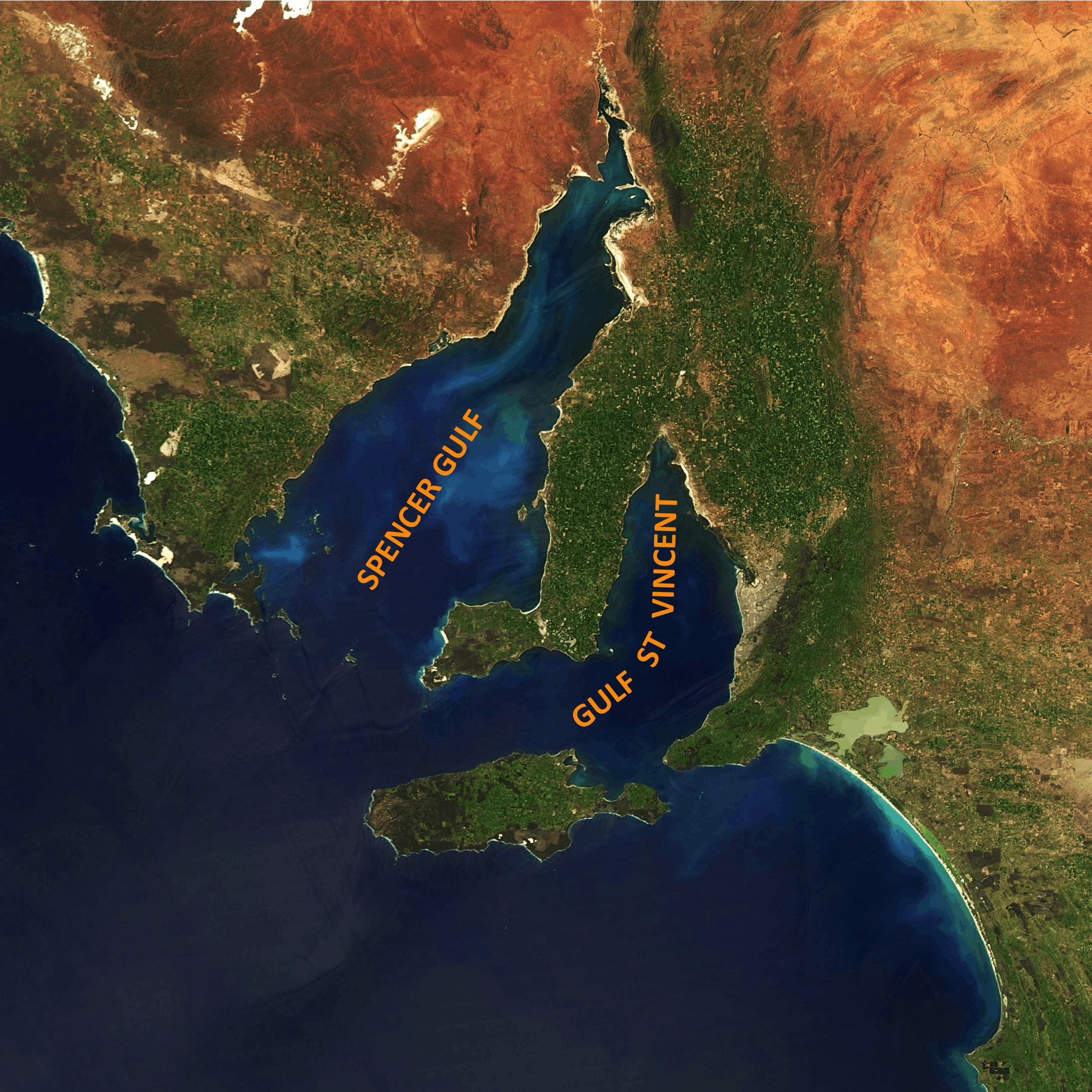
English: A satellite image of the southerly half of South Australia, centred on Spencer Gulf and Gulf St Vincent |
| Date | |
| Source | NASA gallery (http://rapidfire.sci.gsfc.nasa.gov/gallery/?2010283-1010/Australia.A2010283.0435.250m.jpg) |
| Author | NASA |
Licensing
| This file is in the public domain in the United States because it was solely created by NASA. NASA copyright policy states that "NASA material is not protected by copyright unless noted". (See Template:PD-USGov, NASA copyright policy page or JPL Image Use Policy.) | ||
 |
Warnings:
|
File history
Click on a date/time to view the file as it appeared at that time.
| Date/Time | Thumbnail | Dimensions | User | Comment | |
|---|---|---|---|---|---|
| current | 08:12, 19 May 2020 | | 2,151 × 2,151 (5.53 MB) | SCHolar44 | Uploaded a work by NASA from NASA gallery (http://rapidfire.sci.gsfc.nasa.gov/gallery/?2010283-1010/Australia.A2010283.0435.250m.jpg) with UploadWizard |
File usage
The following pages on the English Wikipedia use this file (pages on other projects are not listed):
Global file usage
The following other wikis use this file:
- Usage on es.wikipedia.org
- Usage on mn.wikipedia.org
.png)