
File:Shotley Bridge - geograph-3868856-by-Oliver-Dixon-1.jpg
No higher resolution available.
Shotley_Bridge_-_geograph-3868856-by-Oliver-Dixon-1.jpg (640 × 480 pixels, file size: 117 KB, MIME type: image/jpeg)
| This is a file from the Wikimedia Commons. Information from its description page there is shown below. Commons is a freely licensed media file repository. You can help. |
Summary
| Description |
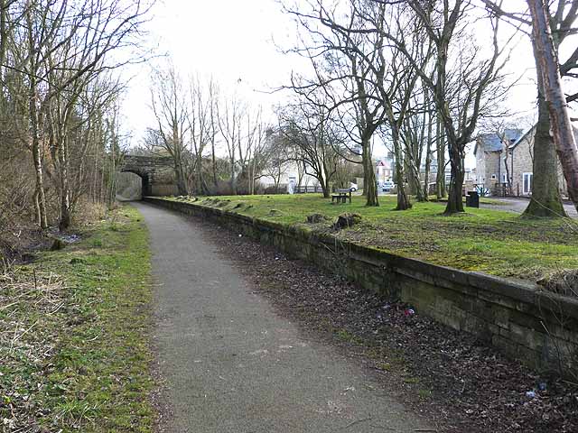
English: The former Shotley Bridge Station Constructed in 1867 and running from Swalwell on the River Tyne up to Consett, the Derwent Valley railway finally closed in 1963. The footway on the line of the old railway has been converted into a cycleway and forms part of National Cycle Network route 14. This old station which closed in 1953 has been converted into a car park and picnic area. The bridge carries the B6310 from Shotley Bridge to Medomsley. |
| Date | |
| Source | From geograph.org.uk |
| Author | Oliver Dixon |
| Permission (Reusing this file) |
Creative Commons Attribution Share-alike license 2.0 |
| Attribution (required by the license) | Oliver Dixon / The former Shotley Bridge Station / |
| Camera location | | View this and other nearby images on: OpenStreetMap |
|---|
_heading:157.00&language=en)
| Object location | | View this and other nearby images on: OpenStreetMap |
|---|
_heading:157.00&language=en)
Licensing

|
This image was taken from the Geograph project collection. See this photograph's page on the Geograph website for the photographer's contact details. The copyright on this image is owned by Oliver Dixon and is licensed for reuse under the Creative Commons Attribution-ShareAlike 2.0 license.
|
This file is licensed under the Creative Commons Attribution-Share Alike 2.0 Generic license.
Attribution: Oliver Dixon
- You are free:
- to share – to copy, distribute and transmit the work
- to remix – to adapt the work
- Under the following conditions:
- attribution – You must give appropriate credit, provide a link to the license, and indicate if changes were made. You may do so in any reasonable manner, but not in any way that suggests the licensor endorses you or your use.
- share alike – If you remix, transform, or build upon the material, you must distribute your contributions under the same or compatible license as the original.
File history
Click on a date/time to view the file as it appeared at that time.
| Date/Time | Thumbnail | Dimensions | User | Comment | |
|---|---|---|---|---|---|
| current | 21:52, 3 December 2020 | | 640 × 480 (117 KB) | Lamberhurst | == {{int:filedesc}} == {{Information |Description={{en|1=<b>The former Shotley Bridge Station</b><br>Constructed in 1867 and running from Swalwell on the River Tyne up to Consett, the Derwent Valley railway finally closed in 1963. The footway on the line of the old railway has been converted into a cycleway and forms part of National Cycle Network route 14. This old station which closed in 1953 has been converted into a car park and picnic area. The bridge carries the B6310 from Shotley Bridg... |
File usage
The following pages on the English Wikipedia use this file (pages on other projects are not listed):